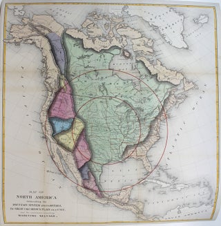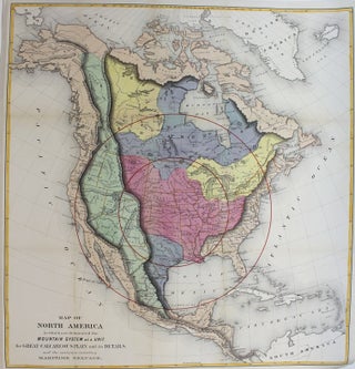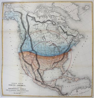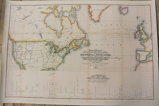
Mercators Projection. Great Circle/Shortest Sailing/or Airlines, Illustrating the directness & capacity of the River St. Lawrence and Lake Erie to the Atlantic, As a means of communication between Europe and the Commercial Centre of the Great West. Shewing also the Extension of the Northern Pacific Railway Route Through Canada. to the Nearest Atlantic Seaport at Montreal.
Montreal: Thos. C. Keefer C. E., c. 1855. Notes: Interesting map of mid 19century depicting sailing and railway routes between Europe and North America. The lower map depicts the northern route for the Pacific Railroad from Lake Michigan to Vancouver Island., Size : 575x874 (mm), 22.64x34.41 (Inches), Coloring: Hand Colored.....