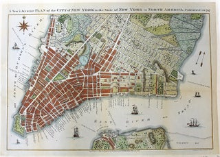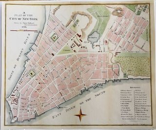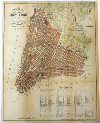
Plan of the City of New York. The greater part from actual survey made expressly for the purpose (the rest from authentic document) By Thomas H. Poppleton 1817. Published by Prior & Dunning.
New York: G. Hayward, 1855. Notes: Plan of New York City by Thomas H. Poppleton, republished in 1855. , Size : 451x351 (mm), 17.76x13.82 (Inches), Coloring: Hand Colored, Category: Maps City Maps; Maps United States East New York New York City;.