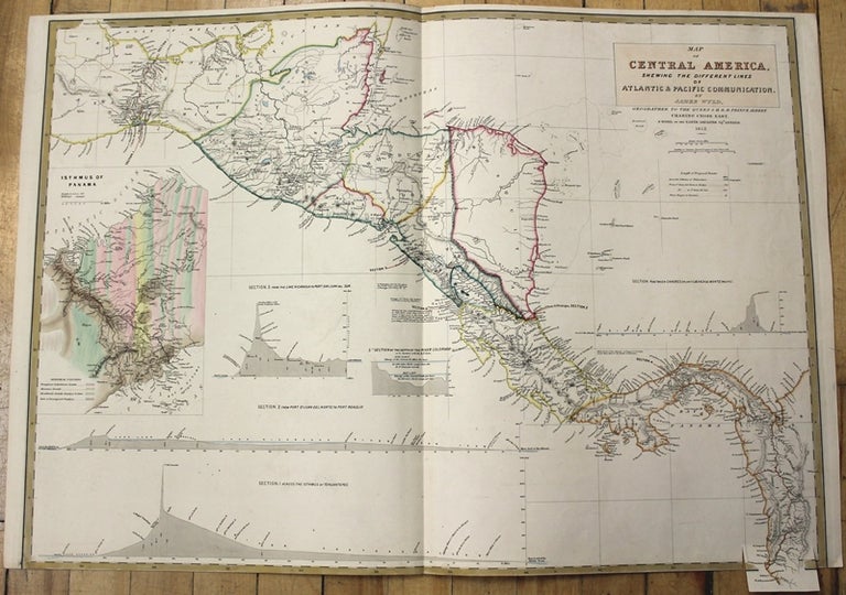
Map of Central America, shewing the Different Lines of Atlantic & Pacific Communication.
London: 1852. Size : 576x810 (mm), 22.68x31.89 (Inches), Coloring: Original Hand Coloring, Category: Maps Central America Countries;. Very Good, lower margin is shaved. Item #M9895
Size : 576x810 (mm), 22.68x31.89 (Inches), Coloring: Original Hand Coloring, Category: Maps Central America Countries;.
Price: $750.00
See all items by James Wyld