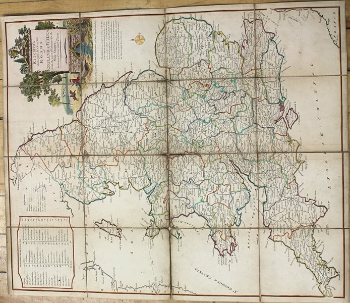
Kitchin's Enlarged Map of the Roads of England & Wales, with the exact Distances by the Mile Stones, between Town and Town.
London: Laurie & Whittle, 1796. Size : 550x450 (mm), 21.65x17.72 (Inches), Coloring: Original Hand Coloring, Category: Maps Europe United Kingdom Wales; Maps Europe United Kingdom England; Maps Folding Maps;. Very Good, backed on original linen. Item #M9817
Size : 550x450 (mm), 21.65x17.72 (Inches), Coloring: Original Hand Coloring, Category: Maps Europe United Kingdom Wales; Maps Europe United Kingdom England; Maps Folding Maps;.
Price: $375.00
See all items in
Maps
See all items by Thomas Kitchin