Paris
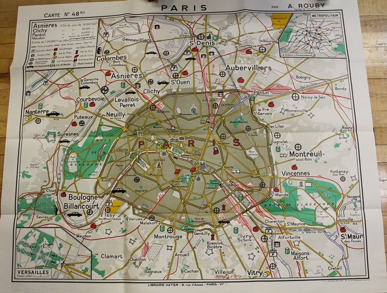
Paris: Librairie Hatier, c.1965. Notes: Charming map of Paris published in the 20th century. The maps shows main roads, railways, metro lines, and various important edifices in Paris. , Size : 916x1118 (mm), 36.06x44.02 (Inches), Coloring: Printed in Color, Category: Maps City Maps; Maps Europe France Paris; Maps Wall Maps; Maps 20th Century Maps;. Very Good, Item #M9780
Notes: Charming map of Paris published in the 20th century. The maps shows main roads, railways, metro lines, and various important edifices in Paris. , Size : 916x1118 (mm), 36.06x44.02 (Inches), Coloring: Printed in Color, Category: Maps City Maps; Maps Europe France Paris; Maps Wall Maps; Maps 20th Century Maps;.
Price: $875.00