
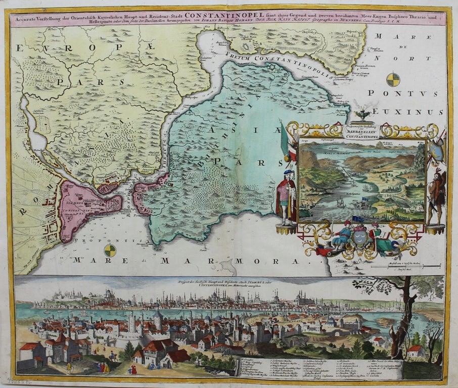
Accurate Vorstellung der Orientalisch Kayserlichen Haupt und Residenz-Stadt Constantinopel
Nuremberg: c.1730. Notes: A fine original hand coloured map of Istanbul during the early 18th century. The map has an elaborate decorative border around two large inset views showing panoramas of the city. There is a legend that shows 30 important buildings (the Seraglio, Hagia Sophia, and various mosques) The Galata Tower is shown, as is the entrance to the Golden Horn before any bridges were built.
, Size : 490x590 (mm), 19.29x23.23 (Inches), Coloring: Original Hand Coloring, Category: Maps Asia Near East Turkey; Maps City Maps;. Very Good. Item #M9677
Notes: A fine original hand coloured map of Istanbul during the early 18th century. The map has an elaborate decorative border around two large inset views showing panoramas of the city. There is a legend that shows 30 important buildings (the Seraglio, Hagia Sophia, and various mosques) The Galata Tower is shown, as is the entrance to the Golden Horn before any bridges were built.
, Size : 490x590 (mm), 19.29x23.23 (Inches), Coloring: Original Hand Coloring, Category: Maps Asia Near East Turkey; Maps City Maps;.
Price: $2,750.00