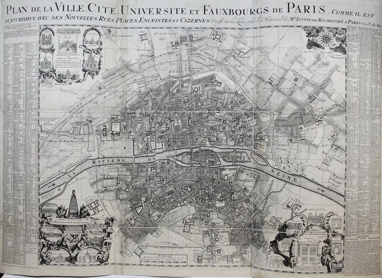
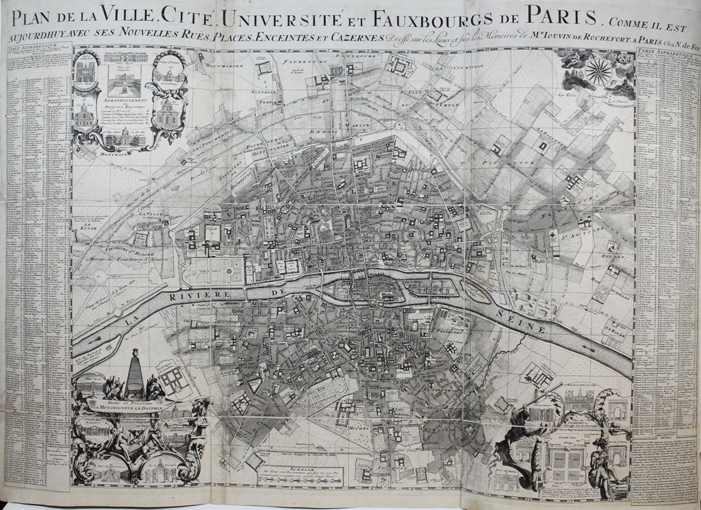
Plan de la Ville, Cite, Universite et Fauxbourgs de Paris, Comme il est
Paris: Nicolas de Fer, c. 1720. Notes: A large-scale and detailed map of the city of Paris and its surroundings during the early 18th century. The map has ornate cartouches in all corners and indexes in the left and right margins.
Nicolas de Fer (1646–1720) was a French cartographer and geographer. He also was an engraver and publisher. His work was most often praised for being beautiful and artistic. , Size : 637x905 (mm), 25.08x35.63 (Inches), Coloring: Hand Colored, Category: Maps City Maps; Maps Folding Maps; Maps Europe France Paris;. Very Good, backed on 19th century paper. Item #M9651
Notes: A large-scale and detailed map of the city of Paris and its surroundings during the early 18th century. The map has ornate cartouches in all corners and indexes in the left and right margins.
Nicolas de Fer (1646–1720) was a French cartographer and geographer. He also was an engraver and publisher. His work was most often praised for being beautiful and artistic. , Size : 637x905 (mm), 25.08x35.63 (Inches), Coloring: Black & White, Category: Maps City Maps; Maps Folding Maps; Maps Europe France Paris;.
Price: $3,750.00