
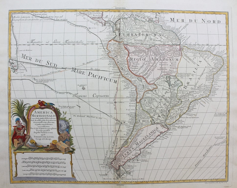
America Meridionalis concinata juxta Observationes Dun Acad. Regalis Scientiarum et nonullorum aliorum, et juxta annotations recentissimas
Augsburg: Tobias Conrad Lotter, c.1772. Notes: A detailed map of South America from the late 18th century. The map has a decorative cartouche and shows major cities, borders, geographical features, notations concerning recent explorations of the interior, and even the routes of various voyages near the Solomon Islands are depicted., Size : 451x582 (mm), 17.76x22.91 (Inches), Coloring: Original Hand Coloring, Category: Maps South America Continent;. Very Good. Item #M9572
Notes: A detailed map of South America from the late 18th century. The map has a decorative cartouche and shows major cities, borders, geographical features, notations concerning recent explorations of the interior, and even the routes of various voyages near the Solomon Islands are depicted., Size : 451x582 (mm), 17.76x22.91 (Inches), Coloring: Original Hand Coloring, Category: Maps South America Continent;.
Price: $375.00