
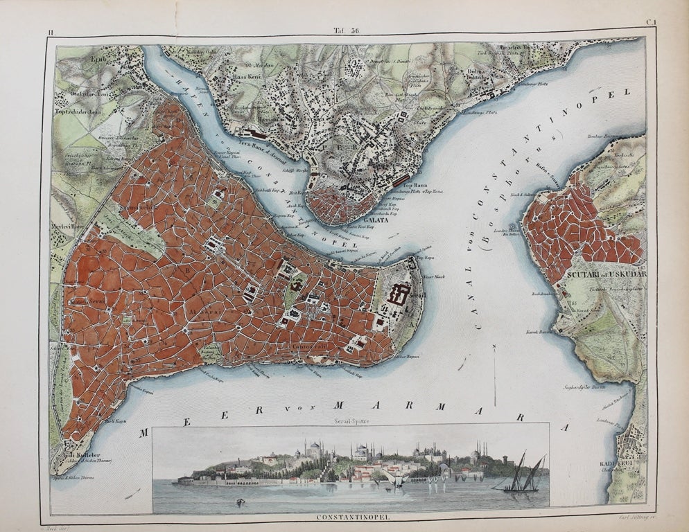
Constantinopel
Berlin: c.1845. Notes: A detailed and attractive map of Constantinople during the mid 19th century. The map shows roads, important buildings, parks and geographical features. There is an inset view of "The Seraglio" - the residence of the Ottoman Sultans. , Size : 206x259 (mm), 8.11x10.20 (Inches), Coloring: Hand Colored, Category: Maps Asia Near East Turkey; Maps City Maps;. Very Good. Item #M9569
Notes: A detailed and attractive map of Constantinople during the mid 19th century. The map shows roads, important buildings, parks and geographical features. There is an inset view of "The Seraglio" - the residence of the Ottoman Sultans. , Size : 206x259 (mm), 8.11x10.20 (Inches), Coloring: Hand Colored, Category: Maps Asia Near East Turkey; Maps City Maps;.
Price: $275.00