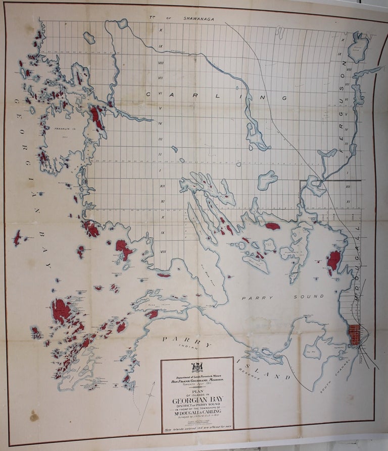
Plan of the Islands in Georgian Bay, District of Parry Sound, in Front of the Townships of McDougal & Carling
Toronto: Department of Lands, Forests & Mines, c.1911. Notes: A large-scale map of Georgian Bay, Ontario, during the early 20th century. The map shows railways, cities, geographical details, surveying information and it even shows which islands were for sale at the time (colored in red). , Size : 905x786 (mm), 35.63x30.94 (Inches), Coloring: Printed in Color with Some Hand Coloring, Category: Maps Wall Maps; Maps Canada Ontario Central;. Very Good, laid on acid free canvas for long term preservation. Item #M9563
Notes: A large-scale map of Georgian Bay, Ontario, during the early 20th century. The map shows railways, cities, geographical details, surveying information and it even shows which islands were for sale at the time (colored in red). , Size : 905x786 (mm), 35.63x30.94 (Inches), Coloring: Printed in Color with Some Hand Coloring, Category: Maps Canada Ontario Central Georgian Bay; Maps Canada Ontario Central Parry Sound; Maps Wall Maps;.
Price: $1,300.00