New York Map-Picture Map in Full Color, Street and Subway Maps.
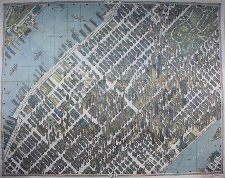
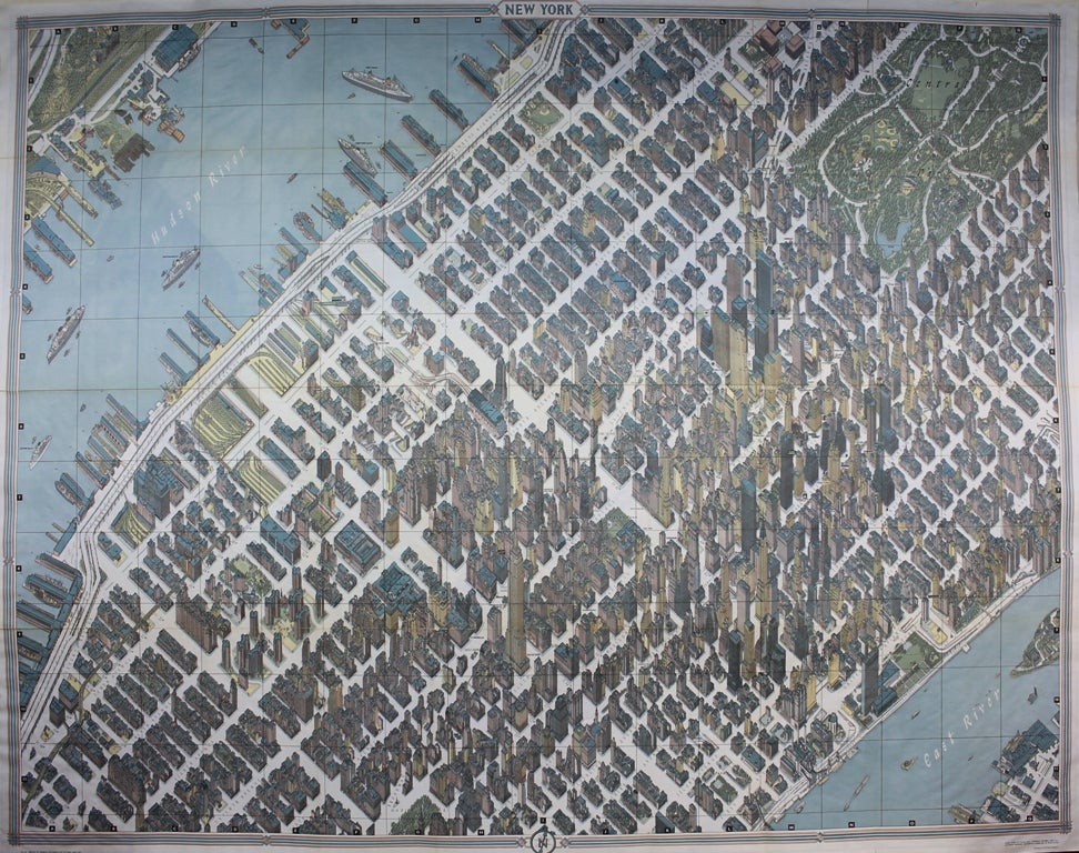
New York: Pictorial Maps Inc./ American Airlines. c.1964. Notes: A large scale, detailed picture map of Manhattan during the mid 20th century.
In order to get the right photograph for Bollmann to work from, special cameras were set up and approximately 67,000 photographs were taken frown various vantage points.
The map shows incredible amounts of detail. Not only does it show every building, park and road, it shows every mailbox, window, and path in Central Park. With its original pamphlet that includes a few pages of text. This is the edition published by American Airlines. , Size : 838x1067 (mm), 33x42 (Inches), Coloring: Printed in Color, Reference: Augustyn, R. T., Cohen, P., Manhattan in Maps 1527 - 1995, 152 - 153. , Category: Maps City Maps; Maps United States East New York New York City; Maps 20th Century Maps;. Very Good. Item #M9530
Notes: A large scale, detailed picture map of Manhattan during the mid 20th century.
In order to get the right photograph for Bollmann to work from, special cameras were set up and approximately 67,000 photographs were taken frown various vantage points.
The map shows incredible amounts of detail. Not only does it show every building, park and road, it shows every mailbox, window, and path in Central Park. With its original pamphlet that includes a few pages of text. This is the edition published by American Airlines. , Size : 838x1067 (mm), 33x42 (Inches), Coloring: Printed in Color, Reference: Augustyn, R. T., Cohen, P., Manhattan in Maps 1527 - 1995, 152 - 153. , Category: Maps City Maps; Maps United States East New York New York City; Maps 20th Century Maps;.
Price: $750.00