
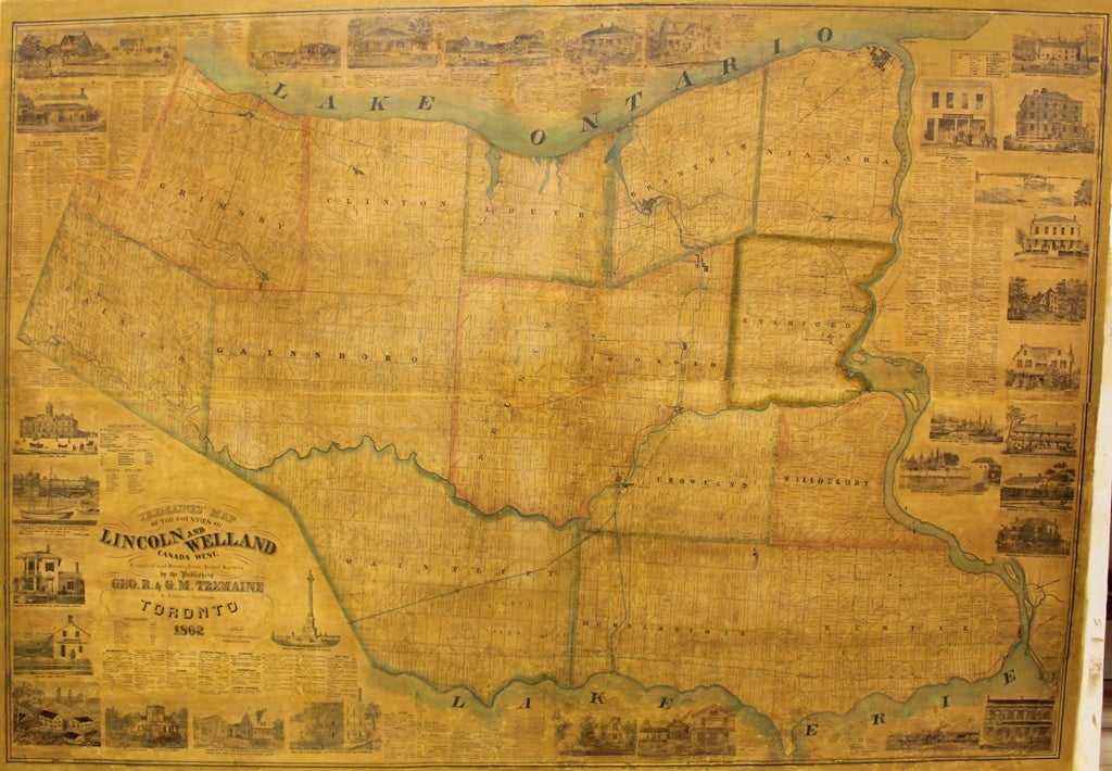
Tremaine's Map of the Counties of Lincoln and Welland
Toronto: Geo. R. & G.M. Tremaine, c.1862. Notes: A scarce and magnificent large-scale map of the counties of Lincoln and Welland, Ontario, during the mid 19th century, by the important and influential cartographers/publishers Tremaine. The map details roadways, railways, borders, geographical features, and city centres. The margins contain 32 vignettes of various important buildings and monuments that can be found in those counties., Size : 1248x1805 (mm), 49.13x71.06 (Inches), Coloring: Hand Colored in Outline, Category: Maps Canada Ontario South Niagara; Maps Wall Maps;. Some skillful restorations, otherwise Good. Laid on acid free canvas for long term preservation. Item #M9376
Notes: A scarce and magnificent large-scale map of the counties of Lincoln and Welland, Ontario, during the mid 19th century, by the important and influential cartographers/publishers Tremaine. The map details roadways, railways, borders, geographical features, and city centres. The margins contain 32 vignettes of various important buildings and monuments that can be found in those counties., Size : 1248x1805 (mm), 49.13x71.06 (Inches), Coloring: Hand Colored in Outline, Category: Maps Canada Ontario South Niagara; Maps Wall Maps;.
Price: $4,500.00