Emisfero Terrestre Settentrionale
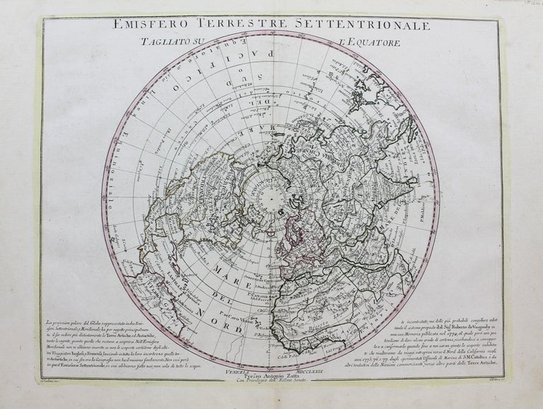
Venice: 1779. Notes: A polar projection of the earth's Northern Hemisphere from the late 18th century, based on Vaugondy's map.
An interesting aspect of this map is the portrayal of a Northwest Passage through the Strait of Anian to Hudson Bay. The Mississippi River is also shown to connect with the Pacific Ocean through Lanhotan's Longue River., Size : 325x420 (mm), 12.80x16.54 (Inches), Coloring: Original Outline Coloring, Category: Maps Polar Arctic Regions; Maps World;. Very Good. Item #M9342
Notes: A polar projection of the earth's Northern Hemisphere from the late 18th century, based on Vaugondy's map.
An interesting aspect of this map is the portrayal of a Northwest Passage through the Strait of Anian to Hudson Bay. The Mississippi River is also shown to connect with the Pacific Ocean through Lanhotan's Longue River., Size : 325x420 (mm), 12.80x16.54 (Inches), Coloring: Original Outline Coloring, Category: Maps Polar Arctic Regions; Maps World;.
Price: $500.00