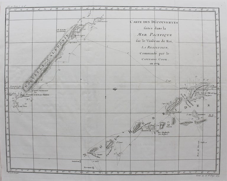
Carte des Decouvertes faites dans la Mer Pacifique
Paris: c. 1774. Notes: A chart detailing the 1774 voyage of Captain Cook in the Pacific near New Caledonia and New Hebrides. The map tracks the voyage of his famous ship, "Resolution," with several dozen stoppage points.
, Size : 360x463 (mm), 14.17x18.23 (Inches), Coloring: Black & White, Category: Maps Ocean Pacific; Maps Pacific;. Very Good. Item #M9338
Notes: A chart detailing the 1774 voyage of Captain Cook in the Pacific near New Caledonia and New Hebrides. The map tracks the voyage of his famous ship, "Resolution," with several dozen stoppage points.
, Size : 360x463 (mm), 14.17x18.23 (Inches), Coloring: Black & White, Category: Maps Oceania (Pacific) Australia; Maps Ocean Pacific;.
Price: $375.00