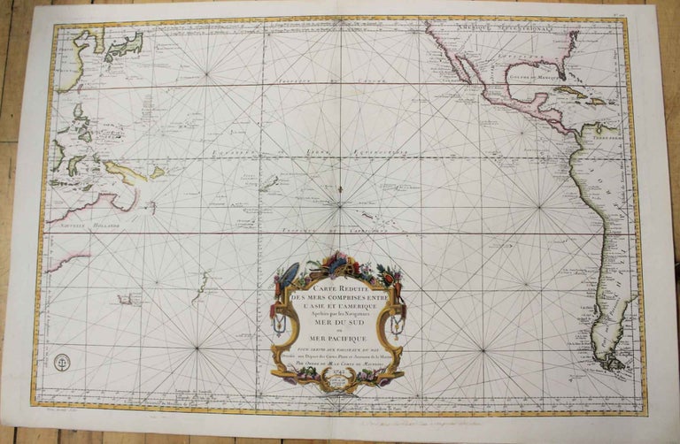
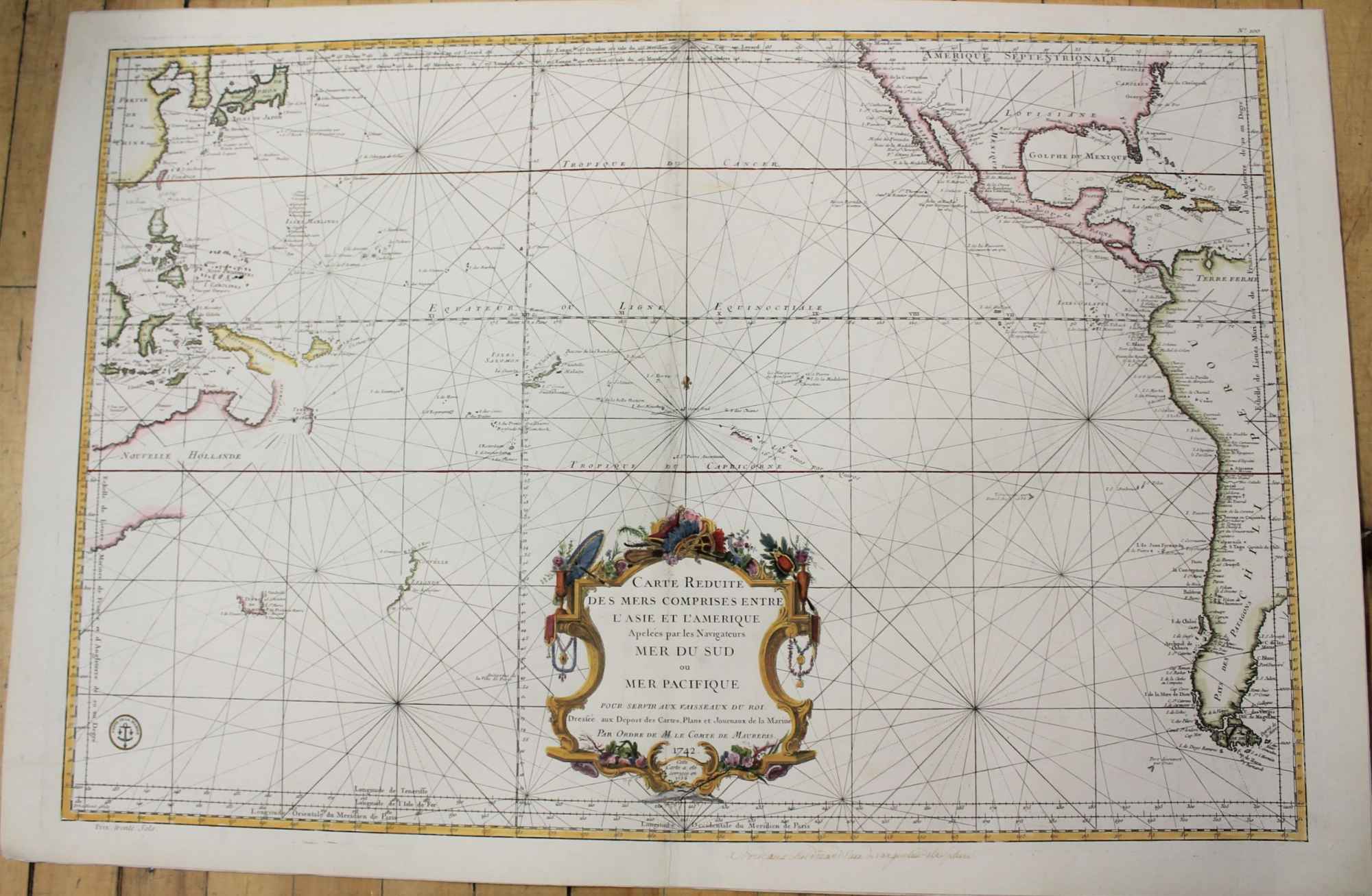
Carte Reduite des Mers Comprises Entre L'Asie et L'Amerique
Paris: Depost des Cartes et Plans et Journaux de la Marine, c.1756. Notes: A map of the Pacific Ocean during the mid 18th century.
This map was created before the onrush of exploration that swept over the Pacific during the late 18th century. This can be seen in the speculative outlines of certain unexplored lands such as Australia and New Zealand (with the thought that New Guinea and Australia were potentially connected) and the exaggerated sizes of Japan and the Korean peninsula. , Size : 570x860 (mm), 22.44x33.86 (Inches), Coloring: Hand Colored, Category: Maps South America Continent; Maps Ocean Pacific; Maps Pacific;. Very Good. Laid on acid free tissue paper for long term preservation. Item #M9260
Notes: A map of the Pacific Ocean during the mid 18th century.
This map was created before the onrush of exploration that swept over the Pacific during the late 18th century. This can be seen in the speculative outlines of certain unexplored lands such as Australia and New Zealand (with the thought that New Guinea and Australia were potentially connected) and the exaggerated sizes of Japan and the Korean peninsula. , Size : 570x860 (mm), 22.44x33.86 (Inches), Coloring: Hand Colored, Category: Maps Oceania (Pacific) New Zealand; Maps South America Continent; Maps Oceania (Pacific) Polynesia; Maps Ocean Pacific; Maps North America;.
Price: $2,000.00