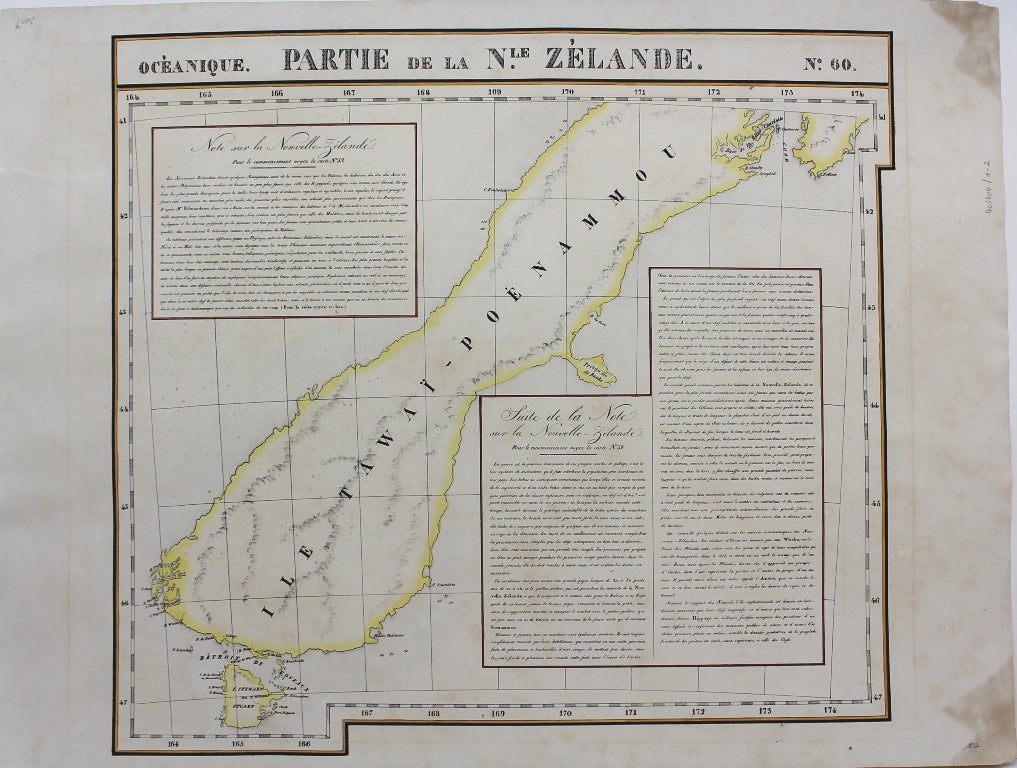
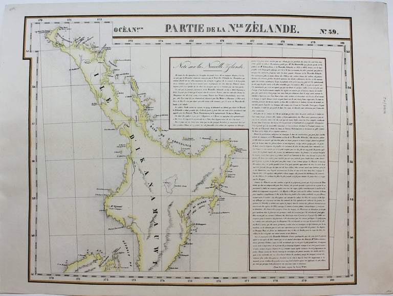
Partie de la Nle. Zelande No. 59 and No. 60
Brussels: Philippe Vandermaelen, c. 1827. Notes: A scarce set of maps (one showing the north island and the other the south island) of New Zealand from the early 19th century. This is considered to be one of the first maps to show New Zealand as the core focus. They do an excellent job of showing detail by having the names of various places, showing geographical features, and by keeping that same detail in their portrayal of the numerous smaller islands around New Zealand. To further add to the detailed nature of the map there are extensive notes.
(Measurement for No. 60 is 495x545mm)
, Size : 483x595 (mm), 19.02x23.43 (Inches), Coloring: Original Hand Coloring, Reference: Phillips, 749; Koeman Vdm 1; National Maritime Museum, 179; Wellens-De Donder, L. Philippe Vandermaelen 1795-1869, 4-5., Category: Maps Pacific;. Very Good. Item #M9228
Notes: A scarce set of maps (one showing the north island and the other the south island) of New Zealand from the early 19th century. This is considered to be one of the first maps to show New Zealand as the core focus. They do an excellent job of showing detail by having the names of various places, showing geographical features, and by keeping that same detail in their portrayal of the numerous smaller islands around New Zealand. To further add to the detailed nature of the map there are extensive notes.
(Measurement for No. 60 is 495x545mm)
, Size : 483x595 (mm), 19.02x23.43 (Inches), Coloring: Original Hand Coloring, Reference: Phillips, 749; Koeman Vdm 1; National Maritime Museum, 179; Wellens-De Donder, L. Philippe Vandermaelen 1795-1869, 4-5., Category: Maps Oceania (Pacific) New Zealand;.
Price: $1,750.00