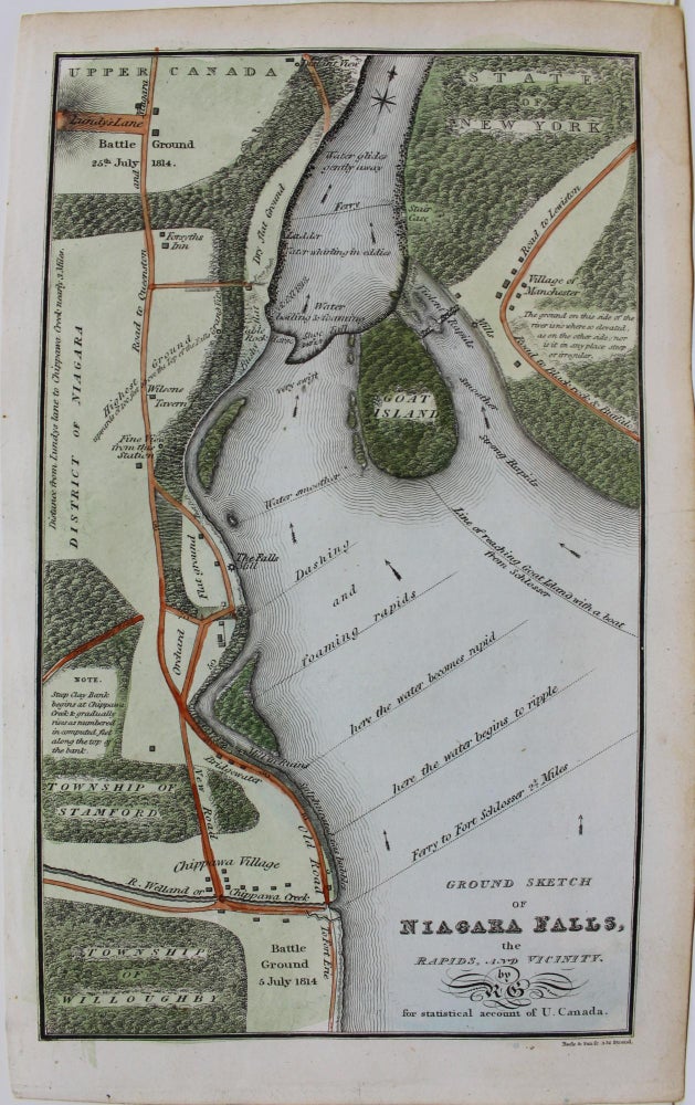
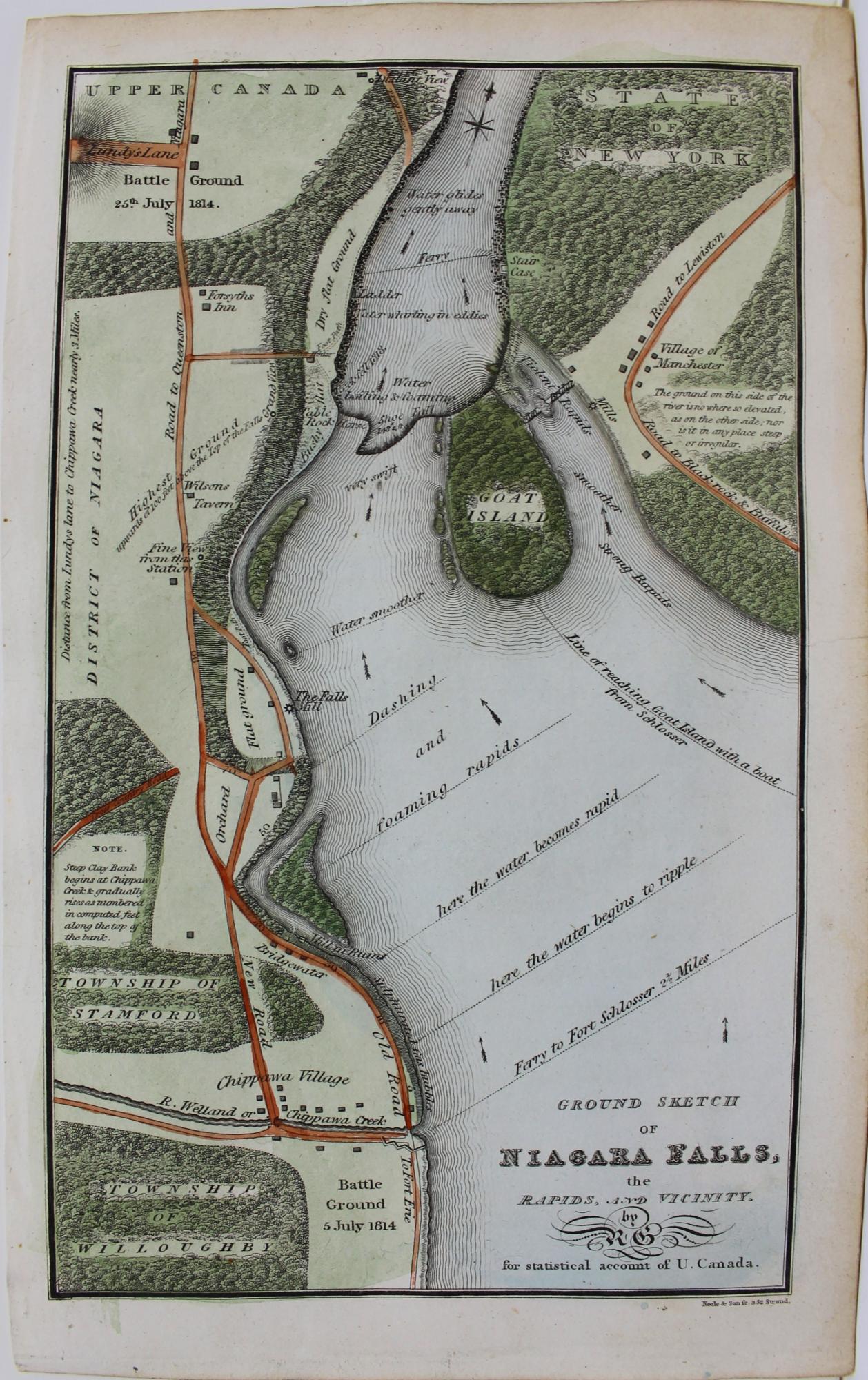
Ground Sketch of Niagara Falls, the Rapids, and Vicinity
London: Longman & Co., c. 1821. Notes: A fascinating map of the Niagara region on both sides of the border that depicts villages, roadways, waterways, forested and cleared areas, and battlegrounds from the War of 1812.
Gourlay emigrated from Scotland to Upper Canada, in 1817. It was in Kingston where he began statistical investigations into the capacity of the province. The purpose of this study was to prepare prospective emigrants as to what life in Upper Canada would be like. He created and distributed a questionnaire to the landowners of Upper Canada, inviting them to share their views on matters of the state that stunted the growth of their respective townships. The response he got was the same throughout; the major concerns centred on the crown and Clergy Reserves and the lack of attractive immigration policies. Gourlay began to fight for change, urging Canadians to petition the British to conduct an official inquiry. Surprised by Gourlay's success, the authorities arrested him three times. His Statistical Account, "the chief monument to [his] stay in Upper Canada" (DCB), is the most informative compilation of information on the progress of settlement there at the time. "Though Gourlay made no attempt to analyse them, the 57 township reports he printed present an unrivalled picture of provincial social and economic life." (DCB) , Size : 189x112 (mm), 7.44x4.41 (Inches), Coloring: Hand Colored, Reference: Winerals 727; Bib Can 1254 , Category: Maps Canada Ontario South Niagara; Maps Military;. Very Good. Item #M9182
Notes: A fascinating map of the Niagara region on both sides of the border that depicts villages, roadways, waterways, forested and cleared areas, and battlegrounds from the War of 1812.
Gourlay emigrated from Scotland to Upper Canada, in 1817. It was in Kingston where he began statistical investigations into the capacity of the province. The purpose of this study was to prepare prospective emigrants as to what life in Upper Canada would be like. He created and distributed a questionnaire to the landowners of Upper Canada, inviting them to share their views on matters of the state that stunted the growth of their respective townships. The response he got was the same throughout; the major concerns centred on the crown and Clergy Reserves and the lack of attractive immigration policies. Gourlay began to fight for change, urging Canadians to petition the British to conduct an official inquiry. Surprised by Gourlay's success, the authorities arrested him three times. His Statistical Account, "the chief monument to [his] stay in Upper Canada" (DCB), is the most informative compilation of information on the progress of settlement there at the time. "Though Gourlay made no attempt to analyse them, the 57 township reports he printed present an unrivalled picture of provincial social and economic life." (DCB) , Size : 189x112 (mm), 7.44x4.41 (Inches), Coloring: Hand Colored, Reference: Winerals 727; Bib Can 1254 , Category: Maps Canada Ontario South Niagara; Maps Military;.
Price: $575.00