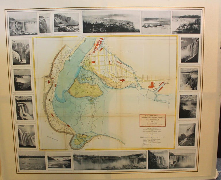
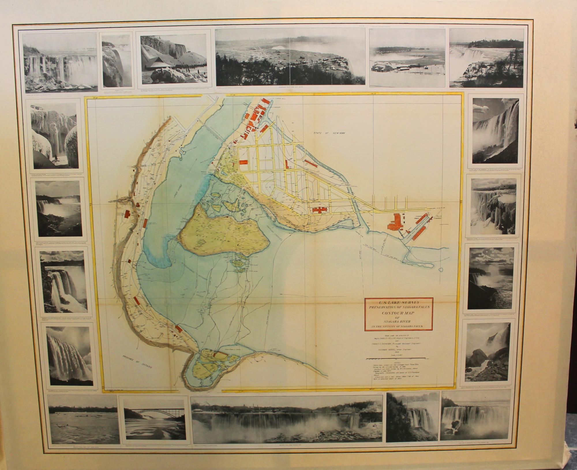
U.S. Lake Survey Preservation of Niagara Falls Contour Map of Niagara River in the Vicinity of Niagara Falls
United States: U.S. Lake Survey, c. 1908. Notes: A fascinating map of the Contour lines of the Niagara River and Niagara Falls at the beginning of the 20th century. A superb overview of both the Canadian side and the American side.
The map is enhanced by period early 20th century photographs of Niagara Falls. , Size : 1230x1400 (mm), 48.43x55.12 (Inches), Coloring: Hand Colored, Category: Maps United States East New York; Maps Wall Maps; Maps 20th Century Maps; Maps Canada Ontario South;. Very Good. Laid on acid free canvas to preserve longevity. Item #M9147
Notes: A fascinating map of the Contour lines of the Niagara River and Niagara Falls at the beginning of the 20th century. A superb overview of both the Canadian side and the American side.
The map is enhanced by period early 20th century photographs of Niagara Falls. , Size : 1230x1400 (mm), 48.43x55.12 (Inches), Coloring: Hand Colored, Category: Maps United States East New York; Maps Canada Ontario South Niagara; Maps Wall Maps; Maps 20th Century Maps;.
Price: $2,500.00