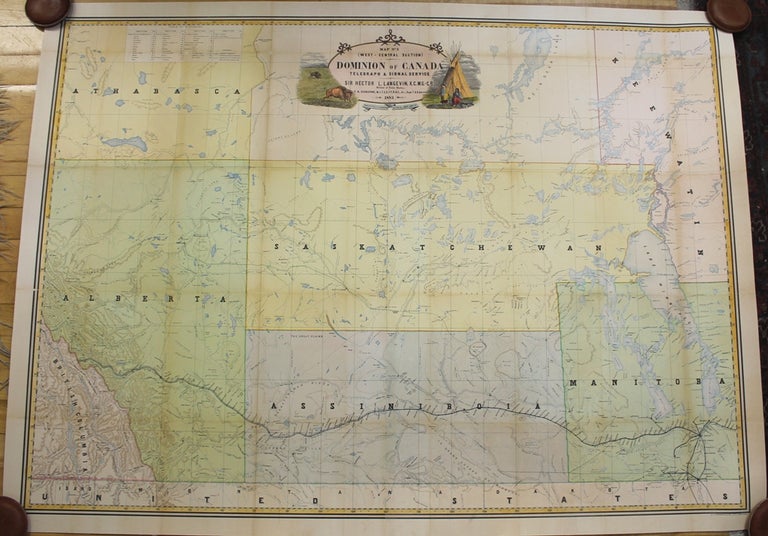
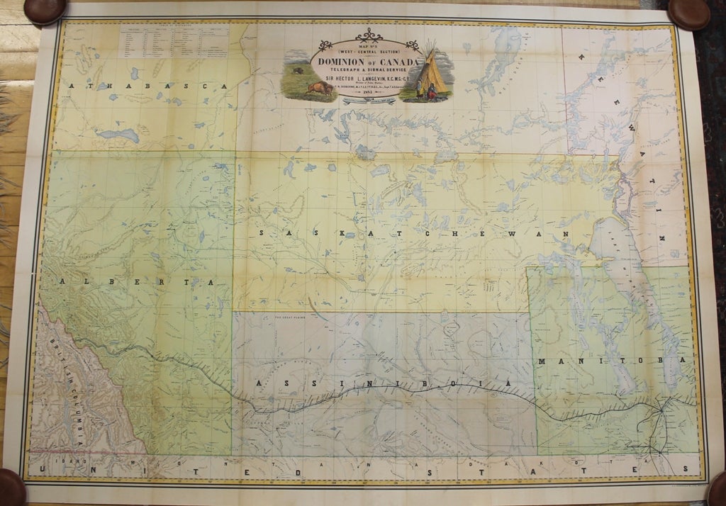
Dominion of Canada Telegraph and Signal Service Map No. 3 (West Central Section)
Montreal: Dominion of Canada Department of Public Works, c. 1883. Notes: A superb large scale wall map of Manitoba, Saskatchewan and Alberta depicting physical and geographical fissures of the Provinces. All major cities, mountain ranges, waterways and railways are depicted. Of particular importance in this map is the depiction of telegraph and signal service throughout the provinces.
Frederic Newton Gisborne (8 March 1824 – 30 August 1892) was a British inventor and electrician.
Born in Broughton, England, he left England in 1842 for a trip around the world, finally settling in Canada in 1845. By close study he became an expert electrician, and original improvements in methods and instruments soon attracted so much attention that he was appointed superintendent of the lines of the Nova Scotia government at Halifax. He laid the first deep-sea cable in North American waters, between Prince Edward Island and New Brunswick in 1852.
In 1879, Gisborne was appointed superintendent of the Canadian government telegraph service, which position he held until his death. Among his numerous inventions were an anti-induction ocean cable, electric and pneumatic ship signals, an anticorrosive composition for the bottoms of iron ships, and an electric recording target.
, Size : 895x1245 (mm), 35.24x49.02 (Inches), Coloring: Hand Colored, Reference: NMC catalogue v. 10, p. 759., Category: Maps Canada Midwest Manitoba; Maps Canada Midwest Saskatchewan; Maps Canada West Alberta; Maps Wall Maps;. Very Good, laid on acid free paper for long term preservation. Item #M9100
Notes: A superb large scale wall map of Manitoba, Saskatchewan and Alberta depicting physical and geographical fissures of the Provinces. All major cities, mountain ranges, waterways and railways are depicted. Of particular importance in this map is the depiction of telegraph and signal service throughout the provinces. , Size : 895x1245 (mm), 35.24x49.02 (Inches), Coloring: Hand Colored, Reference: NMC catalogue v. 10, p. 759., Category: Maps Canada Midwest Manitoba; Maps Canada Midwest Saskatchewan; Maps Canada West Alberta; Maps Wall Maps;.
Price: $3,750.00