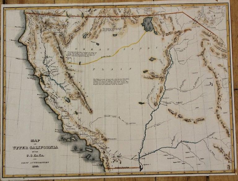
Map of Upper California.
Washington: c.1845. Notes: Significant map of the West, prepared by Charles Wilkes Report of the US Exploring Expedition West of the Rocky Mountains, 1841-45.
The map depicts discoveries of Wilkes, Fremont and others.
, Size : 213x285 (mm), 8.39x11.22 (Inches), Coloring: Hand Colored, Category: Maps United States West California;. Very Good, narrow margins. Item #M9029
Notes: Significant map of the West, prepared by Charles Wilkes Report of the US Exploring Expedition West of the Rocky Mountains, 1841-45.
The map depicts discoveries of Wilkes, Fremont and others.
, Size : 213x285 (mm), 8.39x11.22 (Inches), Coloring: Hand Colored, Category: Maps United States West California;.
Price: $525.00