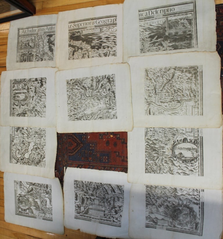
Archiducatus Austriae Superioris Geographica Descriptio
Vienna: c.1669. Notes: An important 17th century wall map of Austria on 11 sheets, 1 sheet is missing. It extends north from Passau to the south at Monastery at Admont. West from Mondsee to the east at Seitenstetten. A highly decorative map with various city views, lakes, castles, towns and churches.
, Size : 1250x1180 (mm), 49.21x46.46 (Inches), Coloring: Black & White, Category: Maps Europe Austria; Maps Wall Maps;. Very Good, published on rare laid blue paper. Item #M8978
Notes: An important 17th century wall map of Austria on 11 sheets, 1 sheet is missing. It extends north from Passau to the south at Monastery at Admont. West from Mondsee to the east at Seitenstetten. A highly decorative map with various city views, lakes, castles, towns and churches.
, Size : 1250x1180 (mm), 49.21x46.46 (Inches), Coloring: Black & White, Category: Maps Europe Austria; Maps Wall Maps;.
Price: $4,000.00