
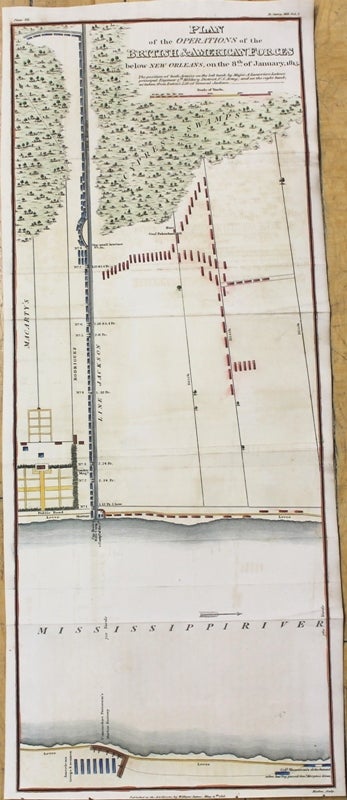
Plan of the Operations of the British & American Forces below New Orleans, on the 8th of January 1815
London: William James, 1818. Notes: Centered on the Mississippi River, this important map shows the positioning of American and British forces around New Orleans during the War of 1812.
, Size : 502x195 (mm), 19.76x7.68 (Inches), Coloring: Hand Colored, Category: Maps Military; Maps United States South Louisiana;. Very Good. Item #M8922
Notes: Centered on the Mississippi River, this important map shows the positioning of American and British forces around New Orleans during the War of 1812.
, Size : 502x195 (mm), 19.76x7.68 (Inches), Coloring: Hand Colored, Category: Maps Military; Maps United States South Louisiana;.
Price: $875.00
See all items in
Maps
See all items by William James