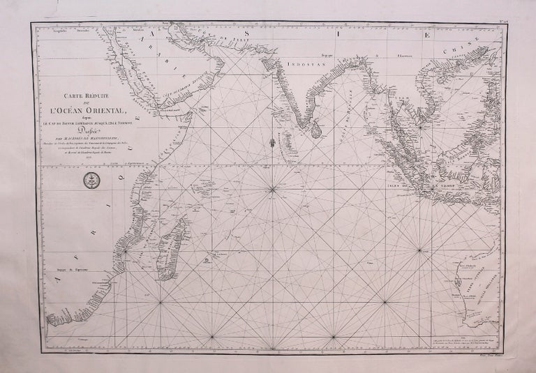
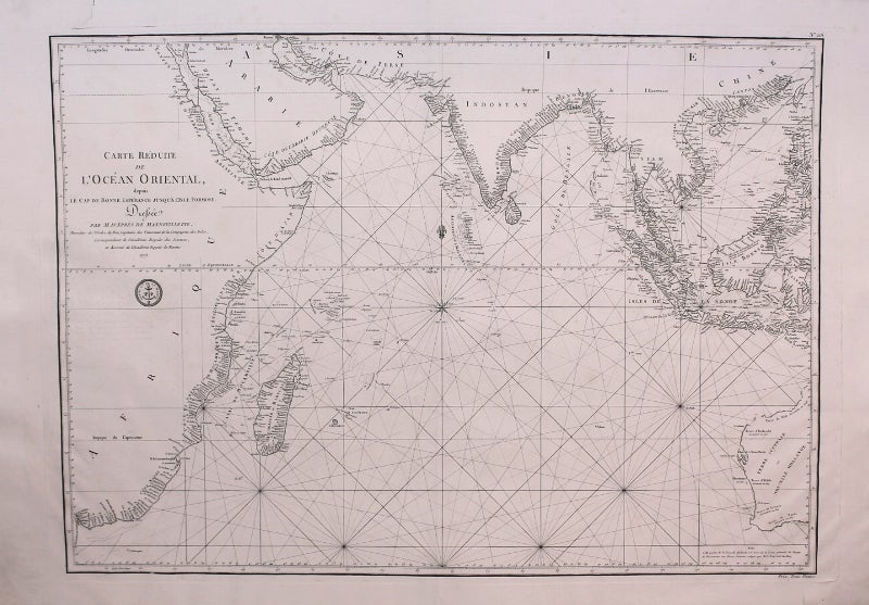
Carte Reduite de L'Ocean Oriental, depuis Le Cap De Bonne Esperance Jusqu'a L'Isle Formose.
Paris: l'Academie Royale e Marine, 1775. Notes: A large scale 18th century sea chart of the Indian Ocean created by prominent cartographer Jean Baptiste Nicholas Denis d'Apres de Mannevillette.
Mannevillette (1707-1780) was a prominent French hydrographer and cartographer. He became captain of the East India Company, and through his career mapped the coasts of India and China. His works were published under the title of Oriental Neptune, and these works enjoyed strong international repute.
, Size : 493x697 (mm), 19.41x27.44 (Inches), Coloring: Black & White, Category: Maps Ocean Indian; Maps Asia South East Indonesia & Papua New Guinea; Maps Asia South East Malaysia & Singapore; Maps Asia South East Thailand, Laos, Vietnam, Cambodia, & Burma / Myanmar; Maps Africa East; Maps Asia Middle East Arabia; Maps Asia Central India & Sri Lanka / Ceylon;. Fine dark impression on thick laid paper. Item #M8879
Notes: A large scale 18th century sea chart of the Indian Ocean created by prominent cartographer Jean Baptiste Nicholas Denis d'Apres de Mannevillette.
Mannevillette (1707-1780) was a prominent French hydrographer and cartographer. He became captain of the East India Company, and through his career mapped the coasts of India and China. His works were published under the title of Oriental Neptune, and these works enjoyed strong international repute.
, Size : 493x697 (mm), 19.41x27.44 (Inches), Coloring: Black & White, Category: Maps Ocean Indian; Maps Asia Central India; Maps Asia South East Indonesia & Papua New Guinea; Maps Asia South East Malaysia & Singapore; Maps Asia South East Thailand, Laos, Vietnam, Cambodia, & Burma / Myanmar; Maps Oceania (Pacific) Australia; Maps Africa East; Maps Asia Middle East Arabia;.
Price: $1,250.00