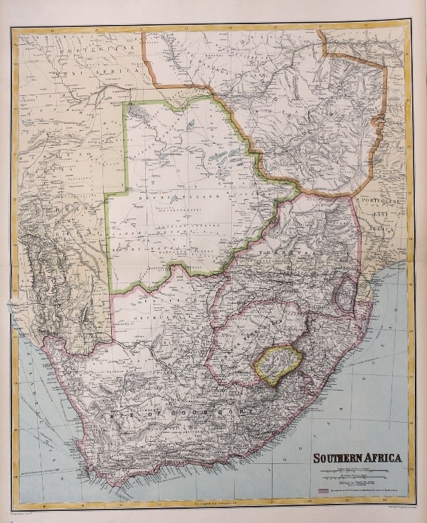
Southern Africa
London: George Philip & Son; London Geographical Institute, c. 1890. Notes: Map of Southern Africa at the late nineteenth century, produced for the London Geographical Institute. Shows in fine detail South Africa, including its provinces the Cape of Good Hope, Orange Free State, Basutu Land, Zulu Land, Swazi Land, as well as Bechuanaland, Matapele Land, currently known as Botswana, and Zimbabwe. , Size : 604x500 (mm), 23.78x19.69 (Inches), Coloring: Printed in Color, Category: Maps Africa South; Maps Wall Maps;. Very Good. Item #M8831
Notes: Map of Southern Africa at the late nineteenth century, produced for the London Geographical Institute. Shows in fine detail South Africa, including its provinces the Cape of Good Hope, Orange Free State, Basutu Land, Zulu Land, Swazi Land, as well as Bechuanaland, Matapele Land, currently known as Botswana, and Zimbabwe. , Size : 604x500 (mm), 23.78x19.69 (Inches), Coloring: Printed in Color, Category: Maps Africa South; Maps Wall Maps;.
Price: $375.00