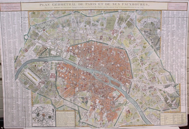
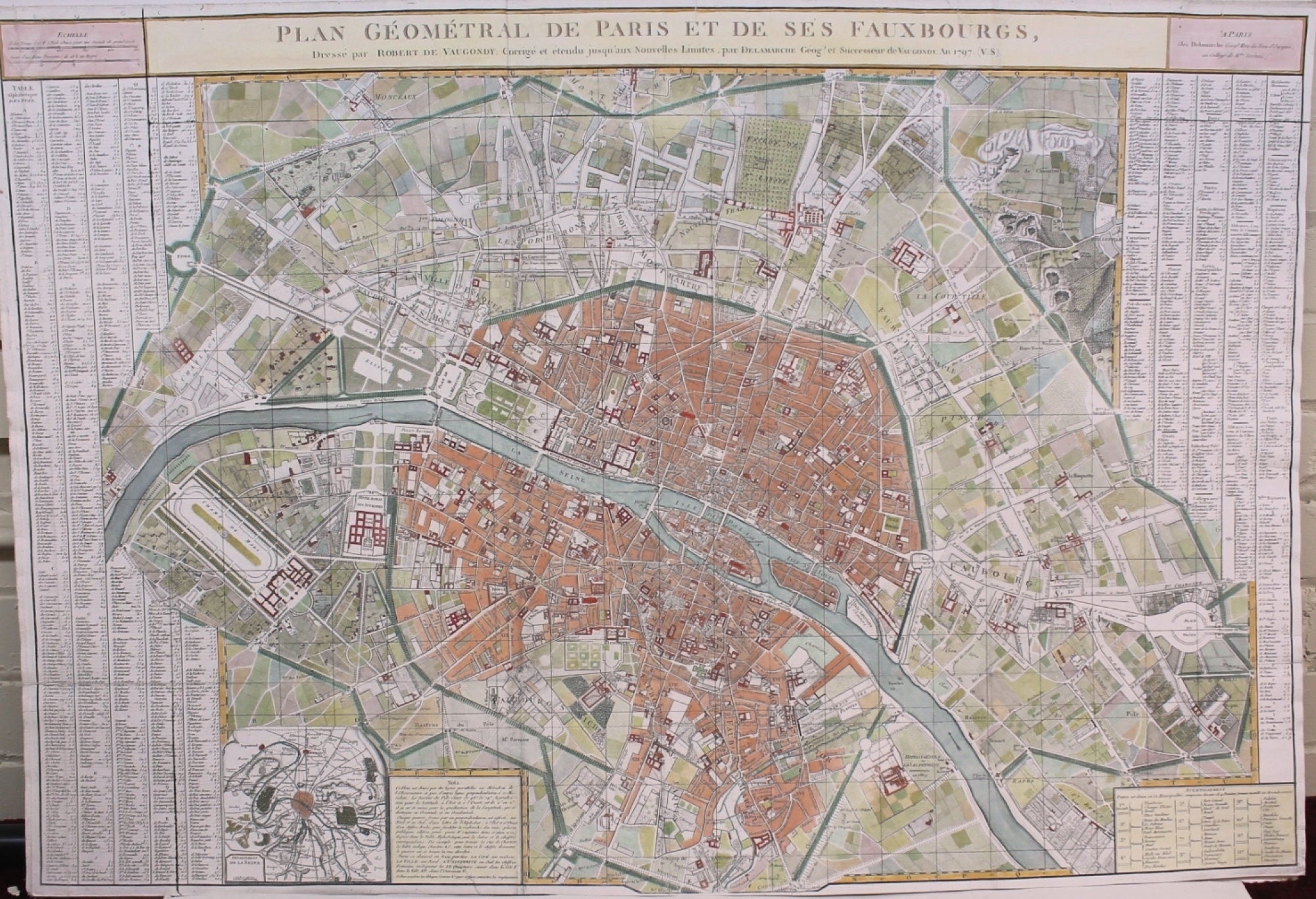
Plan Geometral de Paris et de ses Fauxbourgs, Dresse par Robert de Vaugondy. Corrige et etendu jusqu aux nouvelles limites, par Delamarche Georg et Successeur de Vaugondy An 1797
Paris: Department de le Seine, 1797. Notes: Splendid map of Paris and its suburbs, showing in beautiful detail the river Seine and its bridges, built up urban areas, parks and notable areas, as well as major roadways, and various departments.
Gilles Robert de Vaugondy (1688–1766) and his son, Didier Robert de Vaugondy (c.1723–1786), were leading cartographers in France during the 18th century., Size : 656x972 (mm), 25.83x38.27 (Inches), Coloring: Hand Colored, Category: Maps Europe France Paris; Maps Folding Maps;. Very Good. Item #M8765
Notes: Splendid map of Paris and its suburbs, showing in beautiful detail the river Seine and its bridges, built up urban areas, parks and notable areas, as well as major roadways, and various departments.
Gilles Robert de Vaugondy (1688–1766) and his son, Didier Robert de Vaugondy (c.1723–1786), were leading cartographers in France during the 18th century., Size : 656x972 (mm), 25.83x38.27 (Inches), Coloring: Hand Colored, Category: Maps Europe France Paris; Maps Folding Maps;.
Price: $1,750.00