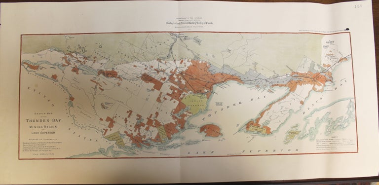
Sketch Map of the Thunder Bay Mining Region of Lake Superior
Montreal: Geological and Natural History Survey of Canada, c. 1887. Notes: A charming map of the Thunder Bay region showing the mining activity around Lake Superior at the end of the 19th Century., Size : 240x652 (mm), 9.45x25.67 (Inches), Coloring: Hand Colored, Category: Maps Geological;Maps Canada Ontario North;. Very Good. Item #M8594
Notes: A charming map of the Thunder Bay region showing the mining activity around Lake Superior at the end of the 19th Century., Size : 240x652 (mm), 9.45x25.67 (Inches), Coloring: Hand Colored, Category: Maps Canada Ontario North Thunder Bay; Maps Geological;.
Price: $475.00
See all items in
Maps
See all items by A. L. Russel, E. D. Ingall