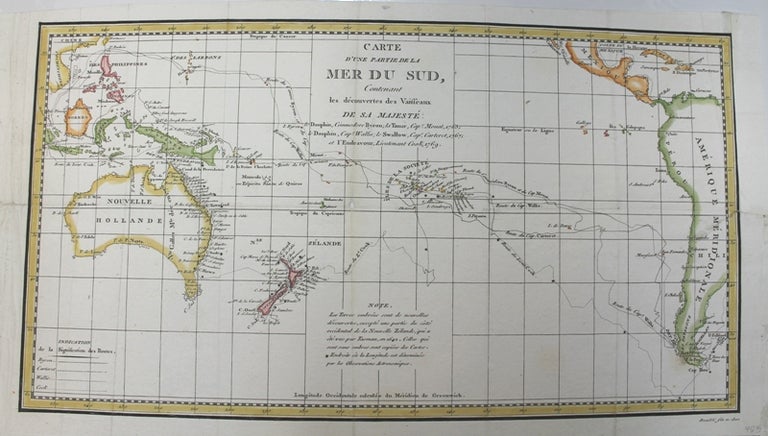
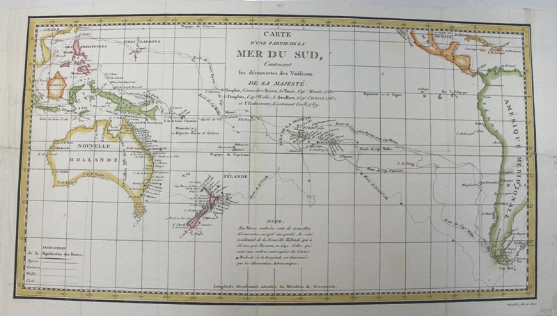
Carte d’une Partie de la Mer du Sud Contenant les Decouvertes de Vaisseaux de sa Majeste
Paris. 1802. Notes: This map is based on the voyages of Captian Cook and other explorers of the South Pacific Ocean between 1765 - 1769. The routes of Byron, Mouats, Wallis, Carteret, and Cook are depicted, with indications of the dates of their travels and their discoveries. The southeastern tip of Australia is still connected to Tasmania, and the inland area is blank as it was still unexplored at the time.
, Size : 178x331 (mm), 7.00x13.05 (Inches), Coloring: Hand Colored in Outline, Category: Maps Pacific;. Very Good. Item #M8248
Notes: This map is based on the voyages of Captian Cook and other explorers of the South Pacific Ocean between 1765 - 1769. The routes of Byron, Mouats, Wallis, Carteret, and Cook are depicted, with indications of the dates of their travels and their discoveries. The southeastern tip of Australia is still connected to Tasmania, and the inland area is blank as it was still unexplored at the time.
, Size : 178x331 (mm), 7.00x13.05 (Inches), Coloring: Hand Colored in Outline, Category: Maps Oceania (Pacific) Australia;.
Price: $475.00