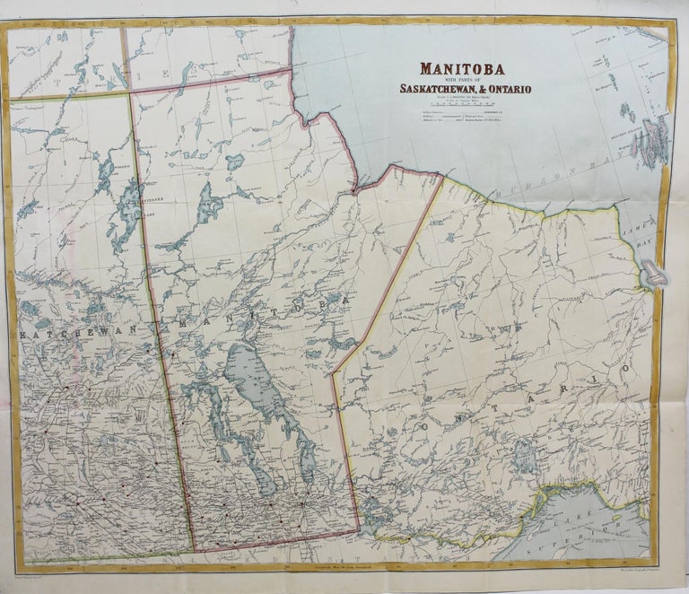
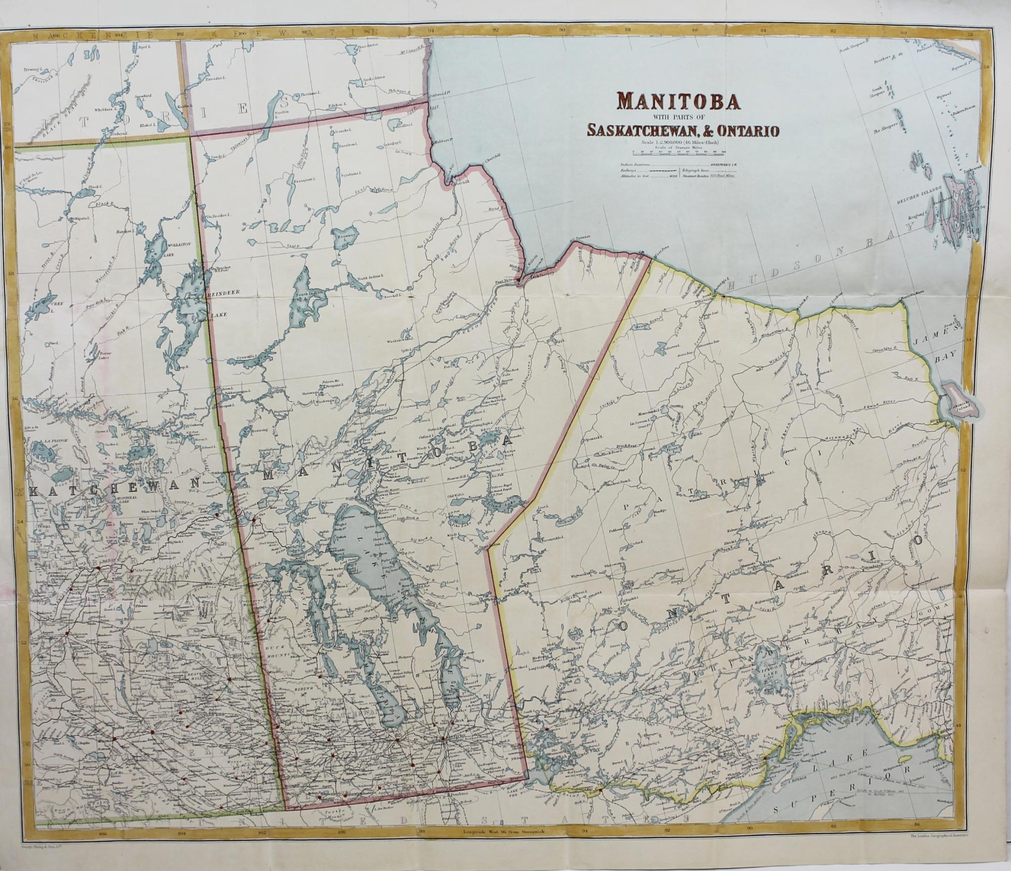
Manitoba With Parts of Saskatchewan & Ontario
London. George Philip & Son, Ltd, c. 1890. Notes: Part of Philip's New Series of Imperial Maps for Tourists and Travelers. The map provides detailed information on Manitoba, Eastern Saskatchewan and Northern Ontario. Various railways are shown. The map depicts rivers, settlements, and territories of the first nation people. , Size : 502x592 (mm), 19.75x23.30 (Inches), Coloring: Hand Colored in Outline, Category: Maps Canada Midwest Manitoba; Maps Canada Midwest Saskatchewan; Maps Canada Ontario North;. Very Good, Folding map laid on original canvas. Item #M8186
Notes: Part of Philip's New Series of Imperial Maps for Tourists and Travelers. The map provides detailed information on Manitoba, Eastern Saskatchewan and Northern Ontario. Various railways are shown. The map depicts rivers, settlements, and territories of the first nation people. , Size : 502x592 (mm), 19.75x23.30 (Inches), Coloring: Hand Colored in Outline, Category: Maps Canada Midwest Manitoba; Maps Canada Midwest Saskatchewan; Maps Canada Ontario North;.
Price: $750.00