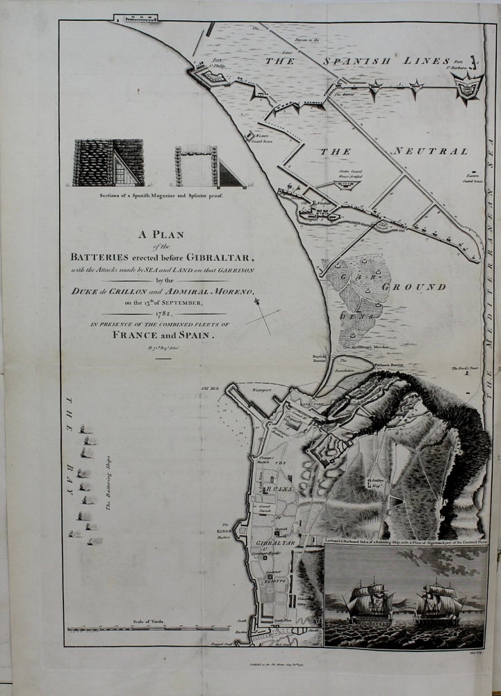
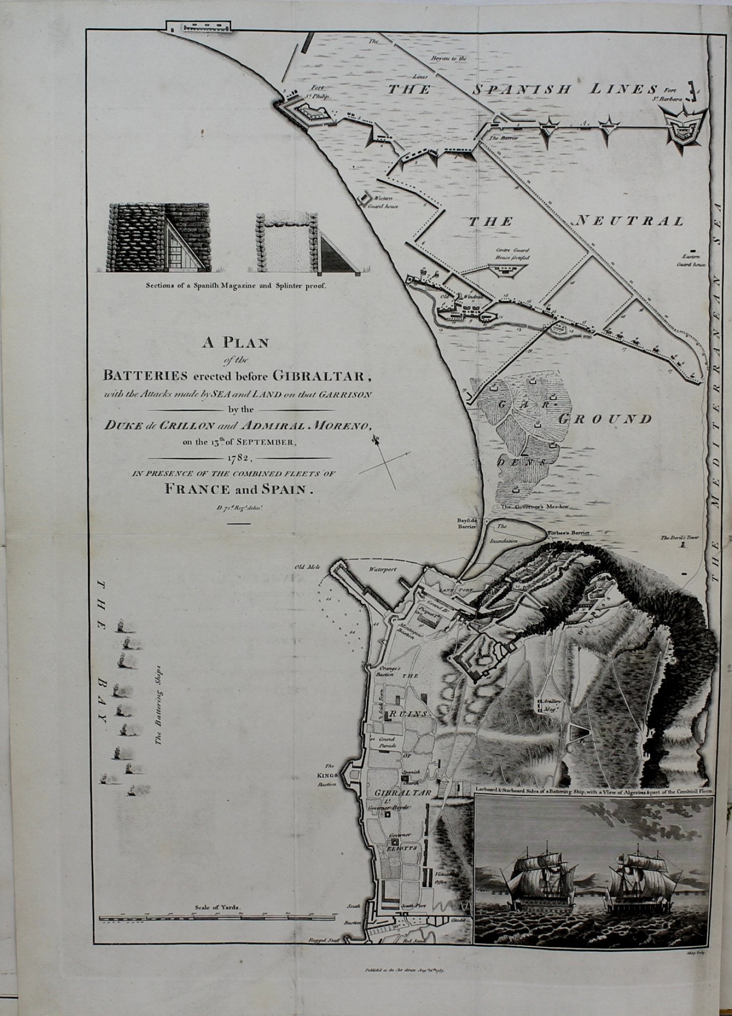
A Plan of the Batteries erected before Gibraltar, with the Attacks made by Sea and Land on that Garrison by the Duke de Crillon and Admiral Moreno, on the 13th of September, 1782, In Presence of the Combined Fleets of France and Spain.
London: c. 1785. Size : 459x317 (mm), 18.07x12.48 (Inches), Coloring: Black & White, Category: Maps Military; Maps Europe Spain;. Very Good, mounted on old canvas, Item #M8038
Size : 459x317 (mm), 18.07x12.48 (Inches), Coloring: Black & White, Category: Maps Mediterranean Gibraltar; Maps Military;.
Price: $475.00
See all items in
Maps
See all items by J. Cheevers