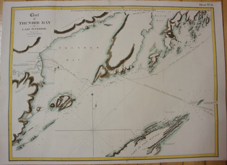
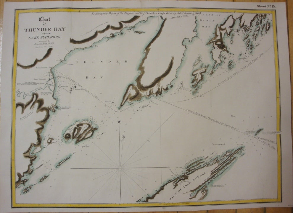
Chart of Thunder Bay; Lake Superior
Montreal: The Desbarats, c. 1874. Notes: This map depicts Thunder Bay and the surrounding islands in Lake Superior originally surveyed by Admiral Bayfield and then updated by the Canadian Pacific Railway. , Size : 435x585 (mm), 17.13x23.03 (Inches), Coloring: Hand Colored in Outline, Category: Maps Sea Chart;Maps Canada Ontario North;. Very Good;. Item #M7740
Notes: This map depicts Thunder Bay and the surrounding islands in Lake Superior originally surveyed by Admiral Bayfield and then updated by the Canadian Pacific Railway. , Size : 435x585 (mm), 17.13x23.03 (Inches), Coloring: Hand Colored in Outline, Category: Maps Canada Ontario North Thunder Bay;Maps Sea Chart;.
Price: $575.00