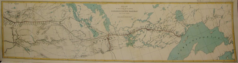
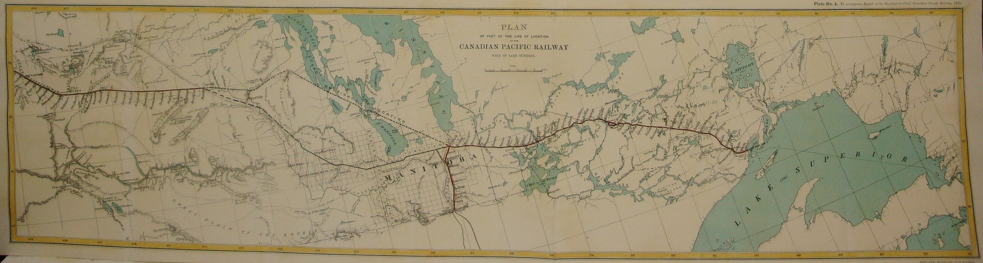
Plan of Part of the Line of Location of the Canadian Pacific Railway West of Lake Superior. / Plate No. 4. To accompany Report of the Engineer-in-Chief, Canadian Pacific Railway, 1880.
Montreal: Canadian Pacific Railway, c. 1880. Notes: This map shows the adjusted course south of Lake Manitoba with the previous route marked by a dotted line passing over Lake Manitoba. The route also eventually routed south through Winnipeg as opposed to passing it to the north at Selkirk., Size : 220x868 (mm), 8.66x34.17 (Inches), Coloring: Printed in Color with Some Hand Coloring, Category: Maps Railroad; Maps Canada;. Very Good;. Item #M7567
Notes: This map shows the adjusted course south of Lake Manitoba with the previous route marked by a dotted line passing over Lake Manitoba. The route also eventually routed south through Winnipeg as opposed to passing it to the north at Selkirk., Size : 220x868 (mm), 8.66x34.17 (Inches), Coloring: Printed in Color with Some Hand Coloring, Category: Maps Railroad; Maps Canada;.
Price: $750.00