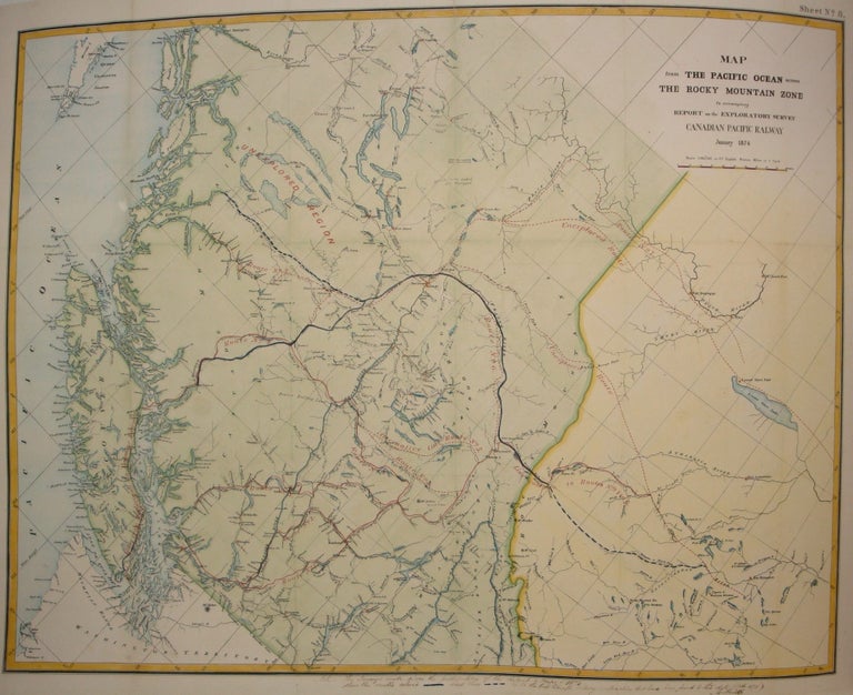
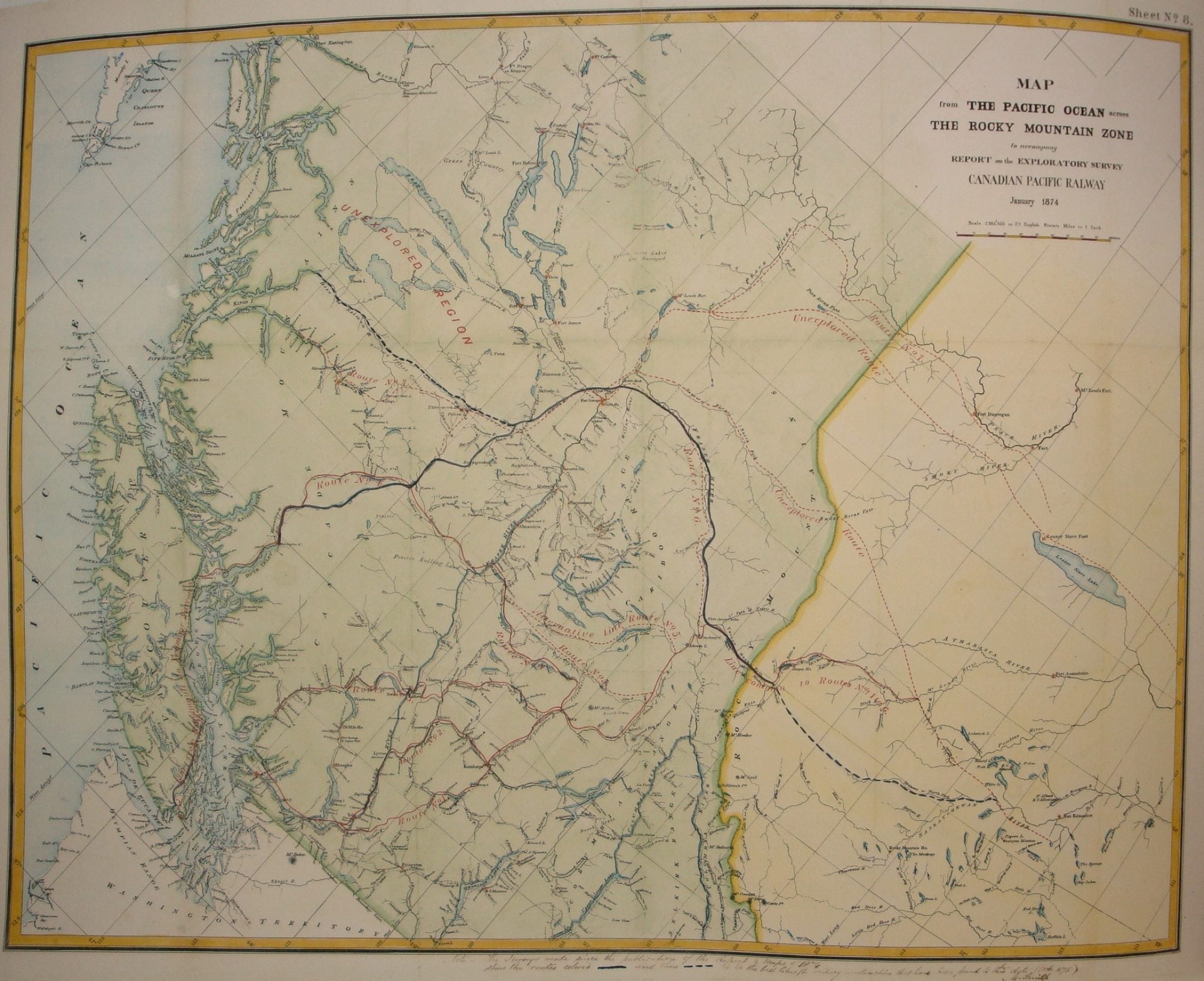
Map from the Pacific Ocean across the Rocky Mountain Zone to accompany Report on the Exploratory Survey / Canadian Pacific Railway
Montreal: Canadian Pacific Railway, 1874. Notes: A very important and early working map of Alberta and British Columbia depicting existing and suggested railways.
There is a note written in period ink in the lower margin, in reference to a contemporary marking of newly suggested routes in black ink:
"Note -- The Surveys made since the publication of the Report & Maps of 1874 shew the routes colored [full black line] and thus [broken black line] to be the best lines for railway construction that have been found to this date (Oct 1875). Mr. Smith".
"Mr. Smith" is believed to be Donald A. Smith, a major partner in the yet-to-be incorporated Canadian Pacific Railway Company in 1881.
The routes marked out in red (as printed) depict potential lines crossing the Rockies to the west of Edmonton at Yellowhead Pass. Almost none of the suggested routes depicted on this map were eventually used--CPR dismissed the use of Yellowhead Pass for a pass farther south in order to discourage competition from railway lines south of the border. They chose instead Kicking Horse Pass, which is depicted on this map., Size : 608x779 (mm), 23.94x30.67 (Inches), Coloring: Hand Colored, Category: Maps Railroad; Maps Canada West British Columbia;Maps Canada West Alberta;. Very Good; laid down on acid-free tissue paper for long-term preservation. Item #M7548
Notes: A very important and early working map of Alberta and British Columbia depicting existing and suggested railways.
There is a note written in period ink in the lower margin, in reference to a contemporary marking of newly suggested routes in black ink:
"Note -- The Surveys made since the publication of the Report & Maps of 1874 shew the routes colored [full black line] and thus [broken black line] to be the best lines for railway construction that have been found to this date (Oct 1875). Mr. Smith".
"Mr. Smith" is believed to be Donald A. Smith, a major partner in the yet-to-be incorporated Canadian Pacific Railway Company in 1881.
The routes marked out in red (as printed) depict potential lines crossing the Rockies to the west of Edmonton at Yellowhead Pass. Almost none of the suggested routes depicted on this map were eventually used--CPR dismissed the use of Yellowhead Pass for a pass farther south in order to discourage competition from railway lines south of the border. They chose instead Kicking Horse Pass, which is depicted on this map., Size : 608x779 (mm), 23.94x30.67 (Inches), Coloring: Hand Colored, Category: Maps Railroad; Maps Canada West British Columbia;Maps Canada West Alberta;.
Price: $1,750.00