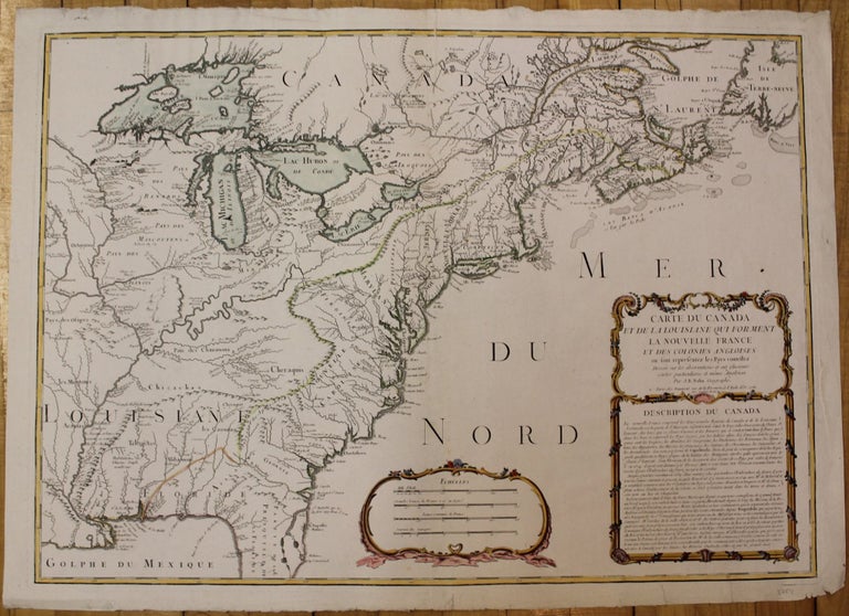
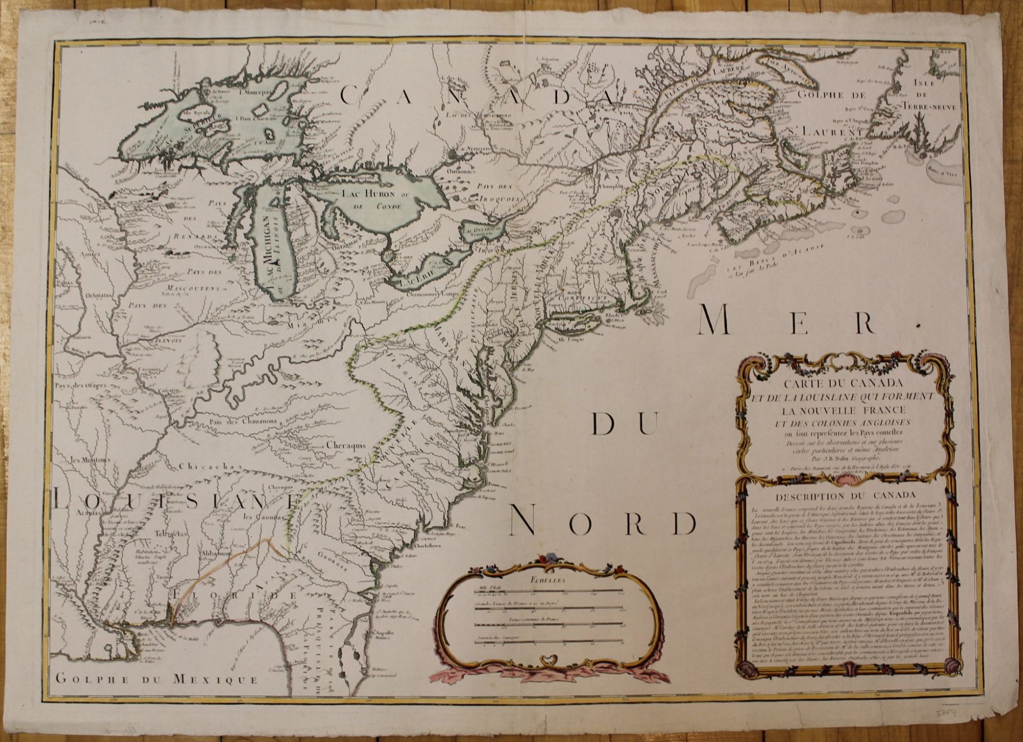
Carte du Canada et de la Louisiane qui forment la Nouvelle France et des colonies Angloises ou sont representez les Pays contestez. Dresee sur les observations et sur plusieurs Cartes particulieres et même Angloises
Paris: Daumont, 1756. Notes: From Homman \"Erben\'s Compendiarivs\"; This is an important and rare pre-revolutionary French Indian war map, which focuses on the territorial claims of France and Great Britain. \"Shows towns and cities, some forts, Indian villages, and tribal territory, and relief. Includes the following text: \'Description du Canada.\'\"-Sellers and Van Ee, Size : 510x715 (mm), 20.125x28.125 (Inches), Coloring: Original Hand Coloring in outline, Reference: LC Maps of North America, 1750-1789, #72; McCorkle 756.12; Smith (1963) 72; Sellers and Van Ee, 72, Category: ; Maps North America Great Lakes; Maps United States East. Very Good. Item #M748
Notes: From Homman \"Erben\'s Compendiarivs\"; This is an important and rare pre-revolutionary French Indian war map, which focuses on the territorial claims of France and Great Britain. \"Shows towns and cities, some forts, Indian villages, and tribal territory, and relief. Includes the following text: \'Description du Canada.\'\"-Sellers and Van Ee, Size : 510x715 (mm), 20.125x28.125 (Inches), Coloring: Original Hand Coloring in outline, Reference: LC Maps of North America, 1750-1789, #72; McCorkle 756.12; Smith (1963) 72; Sellers and Van Ee, 72, Category: ; Maps North America Great Lakes; Maps United States East.
Price: $3,750.00