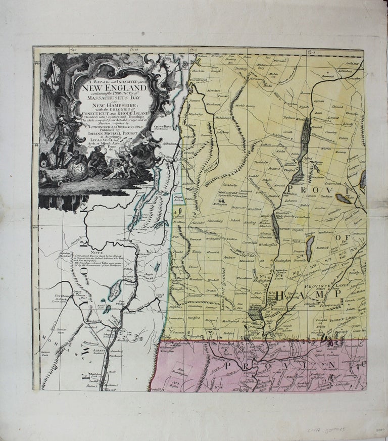
A Map of the Most Inhabited part of New England containing the Provinces of Massachusetts Bay and New Hampshire with the Colonies of Connecticut and Rhode Island, Divided into Counties and Townships.
Augsburg: Probst, c. 1777. Notes: Sheet 1 of this celebrated 4 sheet map, Size : 540x530 (mm), 21.25x20.875 (Inches), Coloring: Original Hand Coloring, Reference: Smith (1963) 108; Sellers and Van Ee 803-804; Edney 6; McCorkle 777.13, Category: Maps United States New England (States);. Excellent. Item #M745
Notes: Sheet 1 of this celebrated 4 sheet map, Size : 540x530 (mm), 21.25x20.875 (Inches), Coloring: Original Hand Coloring, Reference: Smith (1963) 108; Sellers and Van Ee 803-804; Edney 6; McCorkle 777.13, Category: ; Maps United States New England Massachusetts; Maps United States New England Vermont; Maps United States New England New Hampshire.
Price: $2,500.00
See all items by Thomas Jefferys