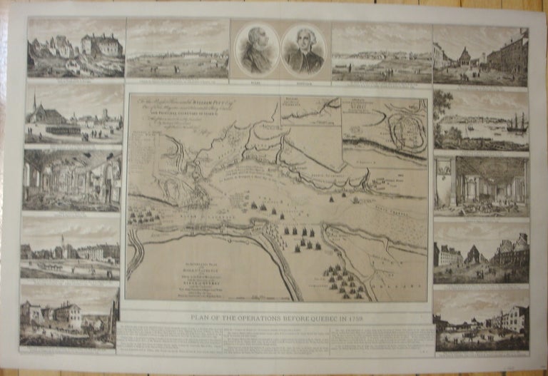
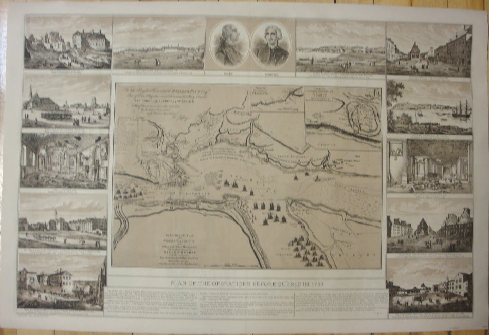
Plan of the Operations Before Quebec in 1759. / An Authentic Plan of the River St. Laurence from Sillery to the Fall of Montmorenci, with the Operations of the Siege of Quebec under the Command of Vice-Adml. Saunders & Major Genl. Wolfe down to the 5. Sepr. 1759. Drawn by a Captain in His Majesties Navy.
Quebec: Quebec Jubilee Illustrated, 1887. Notes: The map is bordered by 12 vignettes from Richard Short's views of the principle buildings of Quebec, drawn on the spot after British occupation of the city in 1759. At the head of the image are the portraits of the two famous opposing commanders: General Wolfe and Marquis de Montcalm., Size : 485x740 (mm), 19.09x29.13 (Inches), Coloring: Black & White, Category: Maps Canada East Quebec Quebec City;. Generally very good; laid down on acid-free tissue paper for long-term preservation. Item #M7432
Notes: The map is bordered by 12 vignettes from Richard Short's views of the principle buildings of Quebec, drawn on the spot after British occupation of the city in 1759. At the head of the image are the portraits of the two famous opposing commanders: General Wolfe and Marquis de Montcalm., Size : 485x740 (mm), 19.09x29.13 (Inches), Coloring: Black & White, Category: Maps Canada East Quebec Quebec City;.
Price: $1,000.00