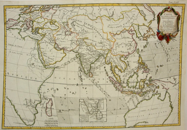
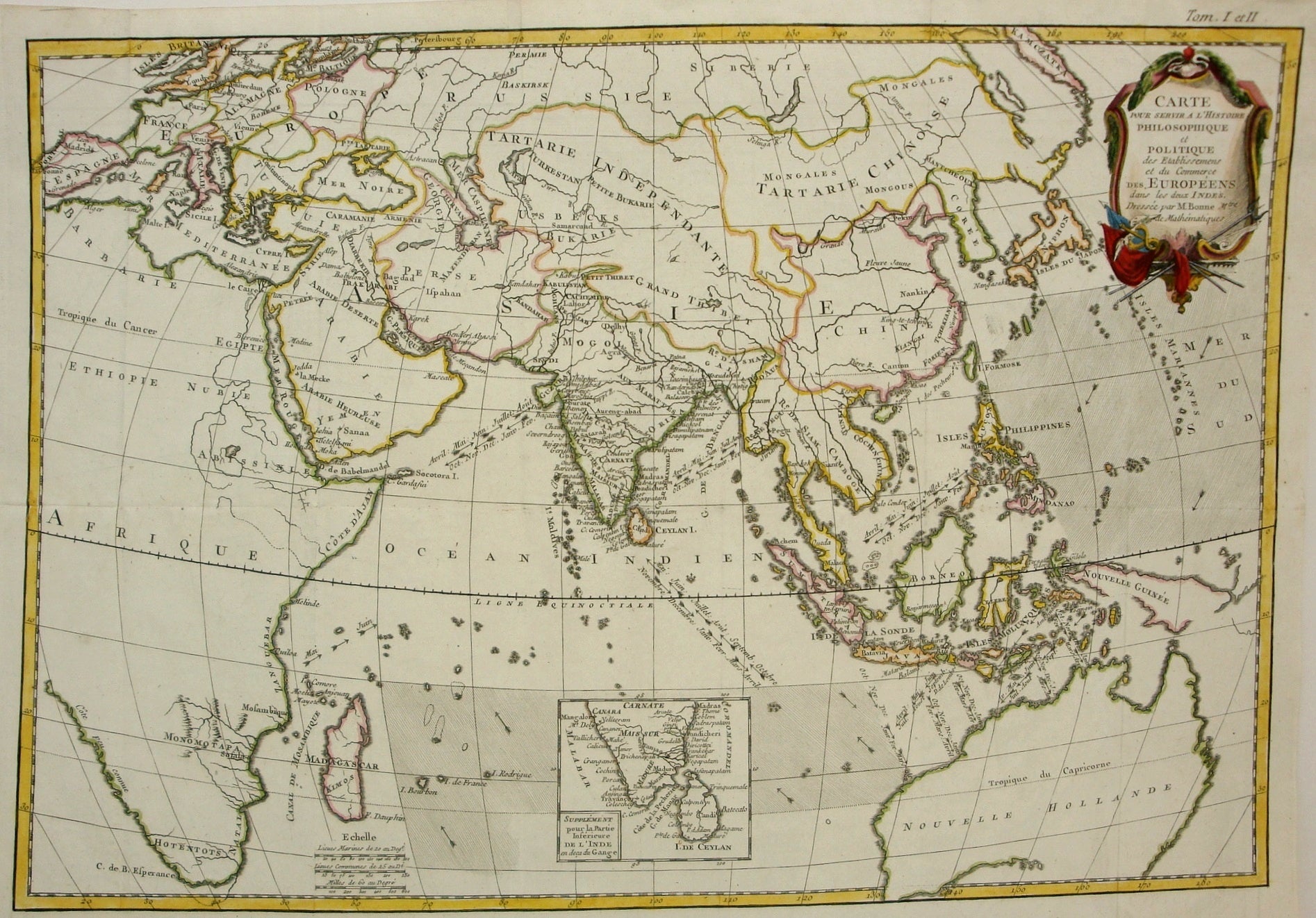
Carte pour servir a l'histoire philosophique et politique des Etablissemens et du Commerce des Europeens dans les deux Indes.
Paris: c. 1765. Notes: An 18th century fine depiction of Australia. The map indicates trade routes, as well as the times of year for particular trade winds in the Indian Ocean. , Size : 314x466 (mm), 12.36x18.35 (Inches), Coloring: Hand Colored in Outline, Category: Maps Asia Continent; Maps Pacific;. Very Good;. Item #M7346
Notes: An 18th century fine depiction of Australia. The map indicates trade routes, as well as the times of year for particular trade winds in the Indian Ocean. , Size : 314x466 (mm), 12.36x18.35 (Inches), Coloring: Hand Colored in Outline, Category: Maps Asia Continent;Maps Oceania (Pacific) Australia;.
Price: $350.00
See all items in
Maps
See all items by Rigobert Bonne