
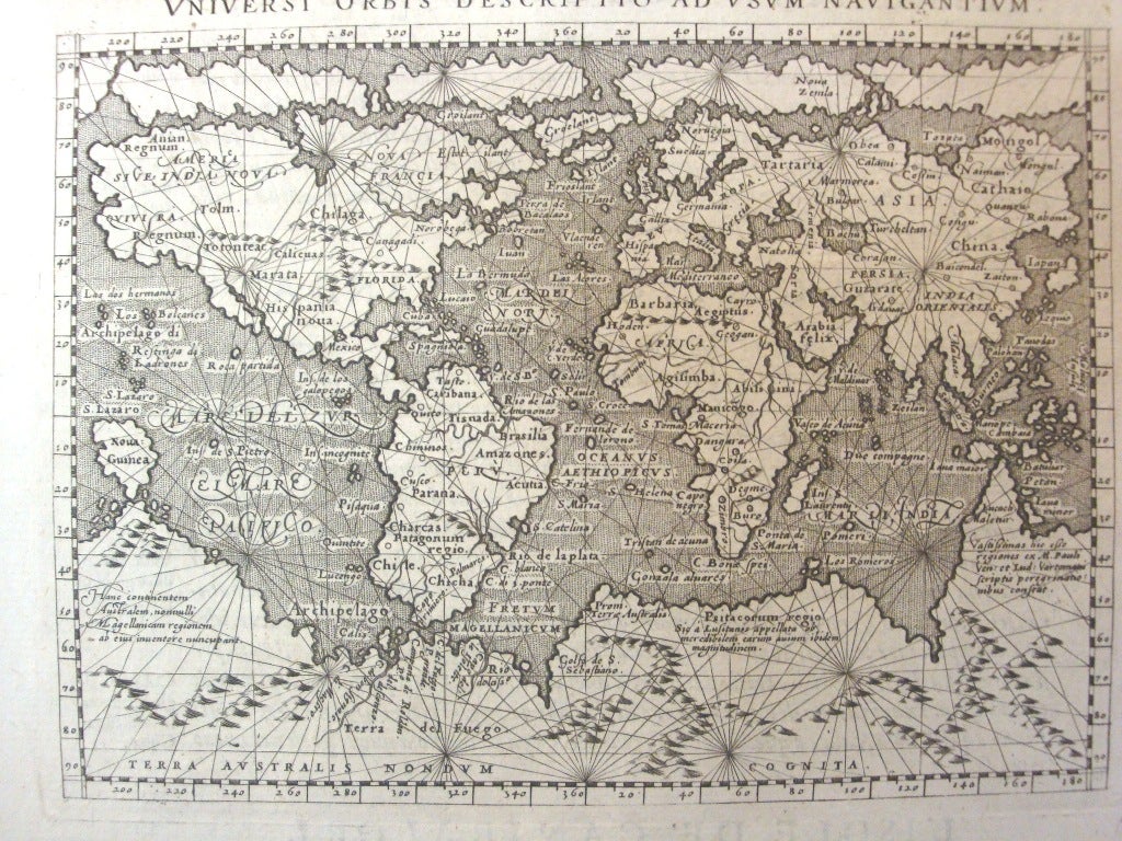
Universi Orbis Descriptio Ad Usum Navigantium
Venice: 1597. Notes: Magini's mariner's map is based on the large world map of Gerard Mercator of 1569. The map depicts a huge southern continent, to which Magini has added fanciful ranges of mountains. A fine network of rhumb lines criss-cross the map and the oceans are stipple engraved in the Italian style. Printed on a full sheet of Italian text with text below the map providing simplified navigational instructions. This map, engraved by Girolamo Porro, is from the Venetian edition of the quarto edition of Ptolemy's Geography that was edited by the distinguished Italian geographer Giovanni Magini.
, Size : 138x180 (mm), 5.43x7.09 (Inches), Coloring: Black & White, Reference: Shirley #196., Category: Maps World;. Very Good;. Item #M7072
Notes: Magini's mariner's map is based on the large world map of Gerard Mercator of 1569. The map depicts a huge southern continent, to which Magini has added fanciful ranges of mountains. A fine network of rhumb lines criss-cross the map and the oceans are stipple engraved in the Italian style. Printed on a full sheet of Italian text with text below the map providing simplified navigational instructions. This map, engraved by Girolamo Porro, is from the Venetian edition of the quarto edition of Ptolemy's Geography that was edited by the distinguished Italian geographer Giovanni Magini.
, Size : 138x180 (mm), 5.43x7.09 (Inches), Coloring: Black & White, Reference: Shirley #196., Category: Maps World;.
Price: $1,500.00