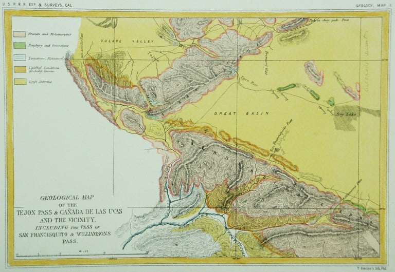
Geological Map of the Tejon Pass & Canada de las Uvas and the Vicinity. Including the Pass of San Francisquito & Williamson's Pass
California: Office of P.R.R. Exp & Surveys, c. 1855. Notes: "Canada de las Uvas" is now the present route of Hwy 5. This is the border between the Sierra Nevada and the Mojave desert., Size : 158x232 (mm), 6.22x9.13 (Inches), Coloring: Hand Colored, Category: Maps Geological; Maps United States West California;. Very Good;. Item #M6993
Notes: "Canada de las Uvas" is now the present route of Hwy 5. This is the border between the Sierra Nevada and the Mojave desert., Size : 158x232 (mm), 6.22x9.13 (Inches), Coloring: Hand Colored, Category: Maps Geological; Maps United States West California;.
Price: $275.00
See all items in
Maps
See all items by William P. Blake