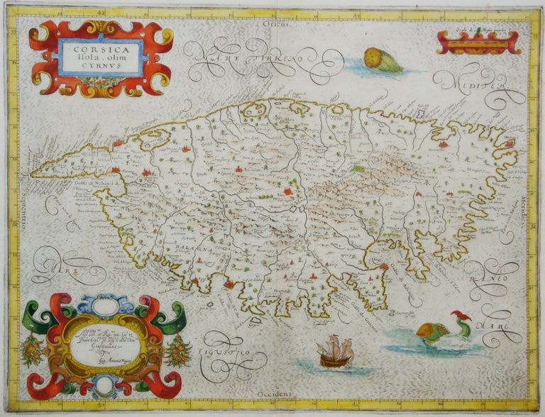
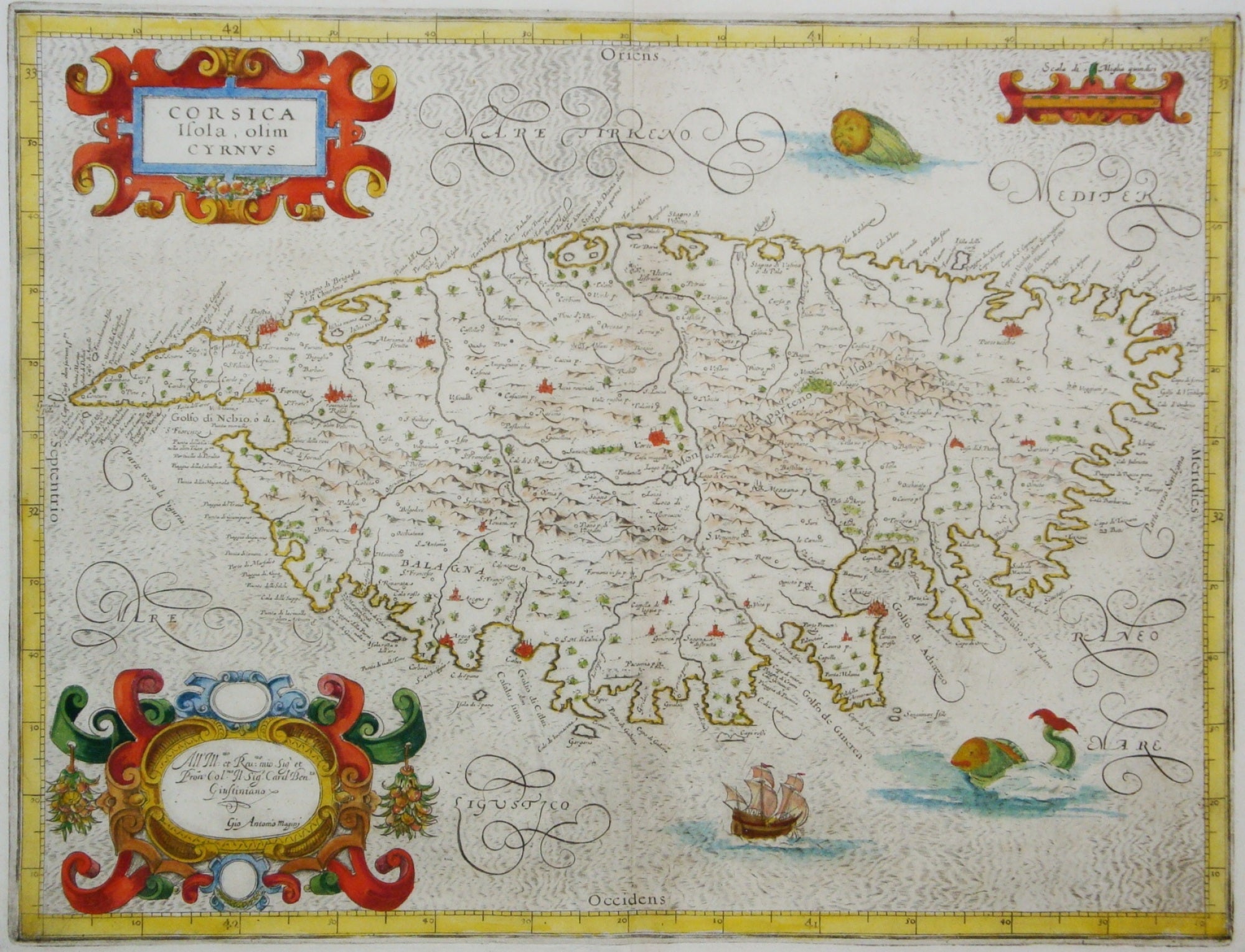
Corsica Isola, olim Cyrnus
Bologna: Fabio Magini, c. 1620. Notes: This decorative map is handsomely coloured with red, gold, green and blue in the title, dedication, and scale cartouches. Place names are written in decorative type, mountain ranges are depicted pictorially, and two sea monsters and a ship decorate the sea. North is oriented to the left.
Giovanni Antonio Magini's "most important work was the first printed atlas of Italy, published posthumously by his son Fabio. These maps were used later by others, including Blaeu and Ortelius." (Tooley), Size : 343x447 (mm), 13.50x17.60 (Inches), Coloring: Original Hand Coloring, Reference: Tooley 3:189, Category: Maps Mediterranean Islands;. Very Good;. Item #M6982
Notes: This decorative map is handsomely coloured with red, gold, green and blue in the title, dedication, and scale cartouches. Place names are written in decorative type, mountain ranges are depicted pictorially, and two sea monsters and a ship decorate the sea. North is oriented to the left.
Giovanni Antonio Magini's "most important work was the first printed atlas of Italy, published posthumously by his son Fabio. These maps were used later by others, including Blaeu and Ortelius." (Tooley), Size : 343x447 (mm), 13.50x17.60 (Inches), Coloring: Original Hand Coloring, Reference: Tooley 3:189, Category: Maps Mediterranean Islands;.
Price: $875.00