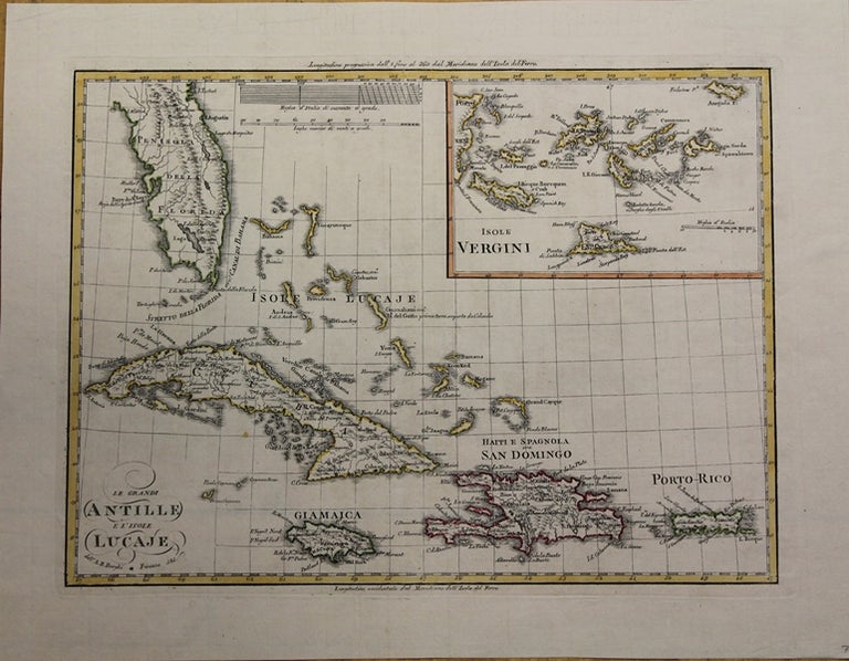
Le Grandi Antille e l'Isole Lucaje
Florence: 1835. Notes: Watermark reads: "Antonio Sferra". Inset map in upper right depicts the Virgin Islands.
Interestingly, despite Haiti's independence, the division between it and the Spanish territory (modern Dominican Republic) is not marked--possibly because many governments refused to acknowledge its existence., Size : 223x303 (mm), 8.78x11.93 (Inches), Coloring: Original Outline Coloring, Category: Maps United States South Florida; Maps West Indies Cuba & Bahamas; Maps West Indies Dominican Republic / Haiti & Puerto Rico;. Very Good;. Item #M6508
Notes: Watermark reads: "Antonio Sferra". Inset map in upper right depicts the Virgin Islands.
Interestingly, despite Haiti's independence, the division between it and the Spanish territory (modern Dominican Republic) is not marked--possibly because many governments refused to acknowledge its existence., Size : 223x303 (mm), 8.78x11.93 (Inches), Coloring: Original Outline Coloring, Category: Maps West Indies Bahamas; Maps West Indies Cuba; Maps West Indies Dominican Republic / Haiti; Maps West Indies Puerto Rico; Maps West Indies Virgin Islands;Maps United States South Florida;.
Price: $475.00