
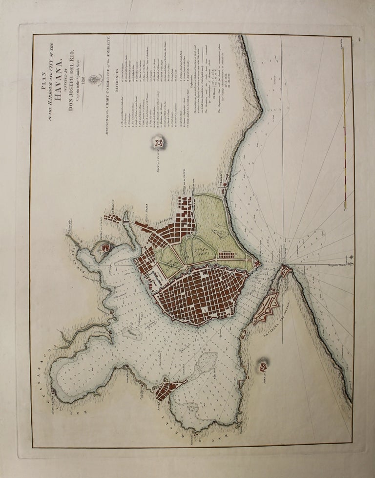
Plan of the Harbour and City of the Havana
London: Chart Committee of the Admiralty, c. 1844. Notes: Originally printed in 1798 in Spanish, later translated by Faden in 1804 and again in 1844. Hydrographic Office seal in top right. The bay is marked with depth soundings. In the upper right of the map is a legend denoting various landmarks and edifices on the map., Size : 446x551 (mm), 17.56x21.69 (Inches), Coloring: Hand Colored, Reference: Cueto 189, Category: Maps City Maps;Maps West Indies Cuba & Bahamas;. Very Good; four small tears in the upper right, right, and lower right margin, professionally repaired and not affecting the image. Item #M6443
Notes: Originally printed in 1798 in Spanish, later translated by Faden in 1804 and again in 1844. Hydrographic Office seal in top right. The bay is marked with depth soundings. In the upper right of the map is a legend denoting various landmarks and edifices on the map., Size : 446x551 (mm), 17.56x21.69 (Inches), Coloring: Hand Colored, Reference: Cueto 189, Category: Maps West Indies Cuba; Maps Sea Chart;Maps City Maps;.
Price: $1,500.00