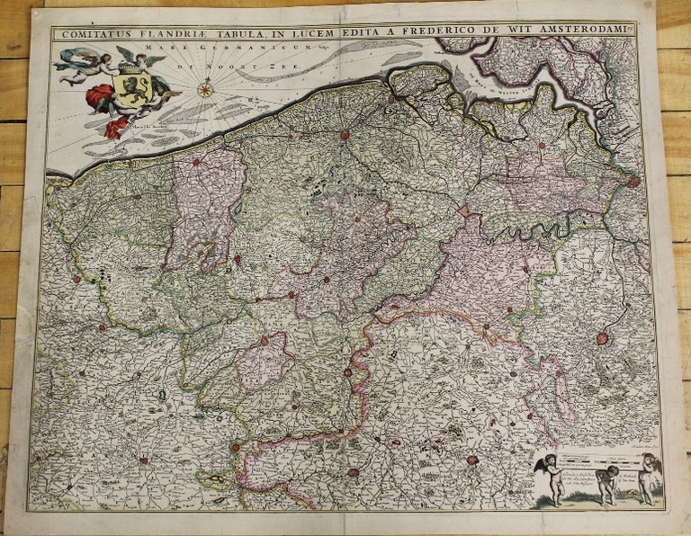
Comitatus Flandriae Tabula in Lucem Edita A Frederico De Wit Amsterodami.
Amsterdam: 1680. Notes: The map depicts western Belgium from Brussels to the sea and northern France., Size : 460x565 (mm), 18.125x22.25 (Inches), Coloring: Original Hand Coloring, Category: Maps Europe Benelux. Very Good, laid on acid free tissue paper for long term preservation and for strengthening the oxidation of the colour pigments. Item #M6294
Notes: The map depicts western Belgium from Brussels to the sea and northern France., Size : 460x565 (mm), 18.125x22.25 (Inches), Coloring: Original Hand Coloring, Category: Maps Europe Benelux.
Price: $575.00
See all items by F. de Wit