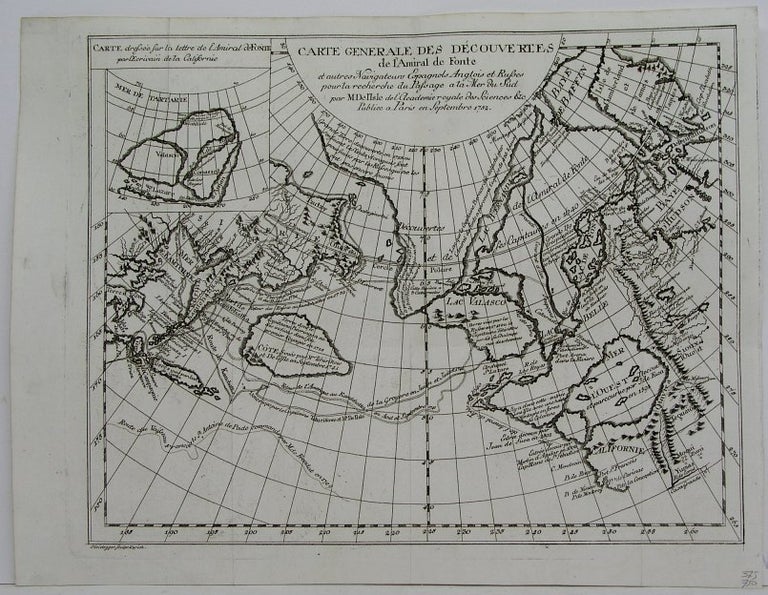
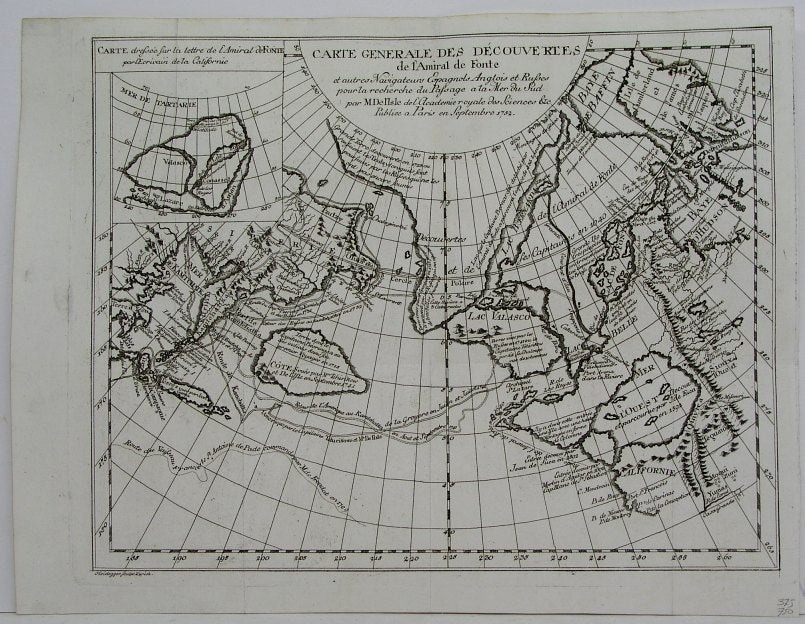
Carte Generale des Decouvertes de l'amiral de Fonte et autres Navigateurs Espagnols Anglois et Russes . . .
Zurich: Heidegger, 1752. Notes: "A track of Admiral Fonte apocryphal discovery of a north-west passage on a voyage in 1640, appeared on various maps of the mid 18th century, including those of Delisle and Le Rouge." (Tooley Vol II pg. 85)
This map is from "Diderot's Enclyclopedie", Size : 290x370 (mm), 11.375x14.5 (Inches), Coloring: Black & White, Category: Maps Polar Arctic Regions;. Very Good. Item #M6262
Notes: "A track of Admiral Fonte apocryphal discovery of a north-west passage on a voyage in 1640, appeared on various maps of the mid 18th century, including those of Delisle and Le Rouge." (Tooley Vol II pg. 85)
This map is from "Diderot's Enclyclopedie", Size : 290x370 (mm), 11.375x14.5 (Inches), Coloring: Black & White, Category: ; Maps Polar Arctic Regions; Maps Russia; Maps Canada Arctic; Maps Polar Arctic Regions Alaska.
Price: $575.00