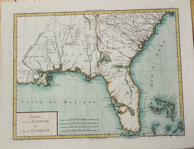
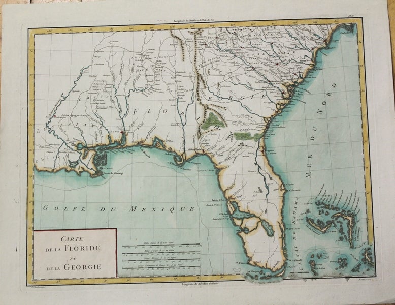
Carte de la Floride et de la Georgie
Paris: c. 1799. Notes: The map depicts Florida during its time under Spanish control. Numerous Indian villages are located and roads are shown connecting early settlements. There are no engraved political divisions indicating the mapmaker's bias toward either the territorial claims of Spain or the United States. The map provides an excellent view of the Gulf Coast with a dramatically over-sized Tampa Bay. Numerous Indian villages are located and roads are shown connecting early settlements. The Bahamas are also well delineated.
, Size : 335x440 (mm), 13.125x17.25 (Inches), Coloring: Hand Colored, Category: Maps United States South Florida; Maps United States South (States);. Very Good. Item #M5632
Notes: The map depicts Florida during its time under Spanish control. Numerous Indian villages are located and roads are shown connecting early settlements. There are no engraved political divisions indicating the mapmaker's bias toward either the territorial claims of Spain or the United States. The map provides an excellent view of the Gulf Coast with a dramatically over-sized Tampa Bay. Numerous Indian villages are located and roads are shown connecting early settlements. The Bahamas are also well delineated.
, Size : 335x440 (mm), 13.125x17.25 (Inches), Coloring: Hand Colored, Category: ; Maps United States South Florida; Maps United States South Georgia.
Price: $875.00