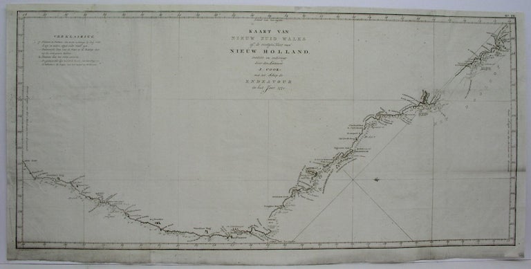
Kaart Van Nieuw Zuid Wales of de Oostyke Kust van Nieuw Holland…
Amsterdam: 1795. Notes: A chart of New South Wales or the East coast of New Holland. Discovered and explored by Lieutenant James Cook commander of his Majesty's Bark Endeavour in the year 1771. After a slow and hazardous passage through the Reef, the Endeavour arrived at 'York Cape', which Cook named after the recently dead Duke of York. On Possession Island, just off the tip of the Cape, he took possession of the east coast of Australia from Cape York to latitude 38 degree south in the name of George III. Confident that this land 'was never seen or visited by any European before us', he hoisted the English colours and named it New South Wales.This was in August 1770; sailing on through the Torres Strait, he arrived home in1771. For the British people. Cook's voyages had staked a claim to a new continent. His prestige as a discoverer was much higher, as it had been given before his death. Important world maps for many years paid tribute to Cook by showing the tracks of his ships. Perhaps the greatest admiration for Cook's exploits was aroused in France.The story of his first voyage, along with his chart of New South Wales, was published in 1773 and translated immediately into French under the auspices of the geographer Gilles Robert de Vaugondy. Crowell page 262., Size : 380x785 (mm), 15x30.875 (Inches), Coloring: Black & White, Category: Maps Pacific;. Very Good; upper left margin extended. Item #M541
Notes: A chart of New South Wales or the East coast of New Holland. Discovered and explored by Lieutenant James Cook commander of his Majesty's Bark Endeavour in the year 1771. After a slow and hazardous passage through the Reef, the Endeavour arrived at 'York Cape', which Cook named after the recently dead Duke of York. On Possession Island, just off the tip of the Cape, he took possession of the east coast of Australia from Cape York to latitude 38 degree south in the name of George III. Confident that this land 'was never seen or visited by any European before us', he hoisted the English colours and named it New South Wales.This was in August 1770; sailing on through the Torres Strait, he arrived home in1771. For the British people. Cook's voyages had staked a claim to a new continent. His prestige as a discoverer was much higher, as it had been given before his death. Important world maps for many years paid tribute to Cook by showing the tracks of his ships. Perhaps the greatest admiration for Cook's exploits was aroused in France.The story of his first voyage, along with his chart of New South Wales, was published in 1773 and translated immediately into French under the auspices of the geographer Gilles Robert de Vaugondy. Crowell page 262., Size : 380x785 (mm), 15x30.875 (Inches), Coloring: Black & White, Category: ; Maps Oceania (Pacific) Australia.
Price: $1,250.00
