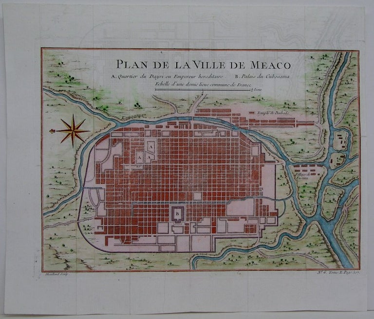
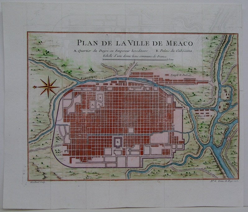
Plan de la Ville de Meaco
Paris: 1764. Notes: Early plan of the Imperial city of Kyoto with the surrounding countryside. The map shows the layout of the city with the principal places of the Emperor and Shogun., Size : 210x275 (mm), 8.25x10.875 (Inches), Coloring: Hand Colored, Category: Maps City Maps; Maps Asia Far East Japan & Korea;. Very Good. Item #M5387
Notes: Early plan of the Imperial city of Kyoto with the surrounding countryside. The map shows the layout of the city with the principal places of the Emperor and Shogun., Size : 210x275 (mm), 8.25x10.875 (Inches), Coloring: Hand Colored, Category: Maps City Maps; Maps Asia Far East Japan.
Price: $375.00