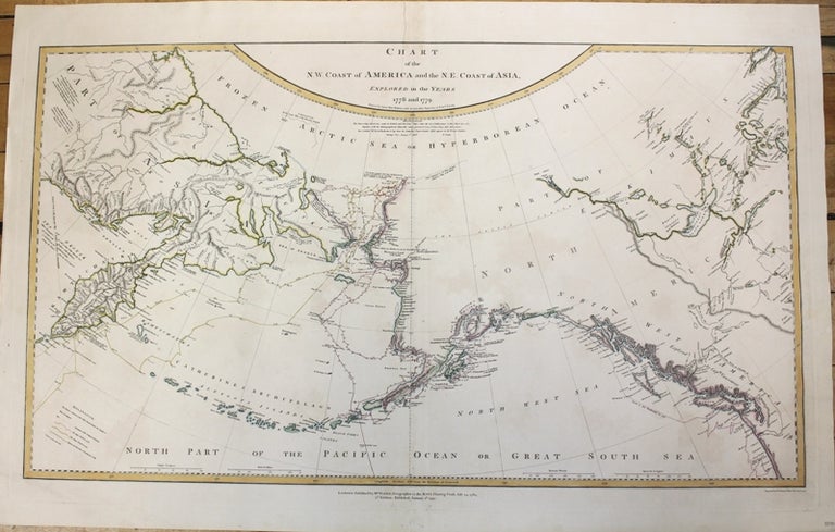
Chart of the N.W. Coast of America and the N.E. Coast of Asia Explored in the Years 1778 and 1779
London: W. Faden, 1794. Notes: An important map of the North West. Published by William Faden as part of his post revolutionary atlas of North America. The map covers from the west coast to Hudsons Bay to Washington state in the south. There is a detailed path of the Captain Cooks voyage is also deliniated., Size : 430x710 (mm), 16.875x27.875 (Inches), Coloring: Original Outline Coloring, Reference: Nebenzahl 5.6, Category: Maps Polar Arctic Regions Alaska, Greenland, Iceland;. Very Good. Item #M4831
Notes: An important map of the North West. Published by William Faden as part of his post revolutionary atlas of North America. The map covers from the west coast to Hudsons Bay to Washington state in the south. There is a detailed path of the Captain Cooks voyage is also deliniated., Size : 430x710 (mm), 16.875x27.875 (Inches), Coloring: Original Outline Coloring, Reference: Nebenzahl 5.6, Category: ; Maps Polar Arctic Regions Alaska.
Price: $1,500.00