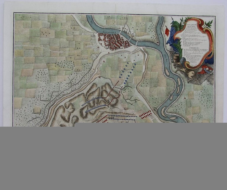
Plan of the Battle of Saragossa, Fought Aug. 9 1710, between the Allies under Lieut. Gen Stanhope and the Marshal Count Staremberg, and the French under the D. of Anjou: the Emperour Charles, and the D of Anjou (King Philip) being both present
London: 1745. Notes: This map is from the atlas " The History of England", Size : 390x485 (mm), 15.375x19.125 (Inches), Coloring: Hand Colored, Reference: Shirley G.Rap-1a 38, Category: Maps City Maps; Maps Europe Spain; Maps Military. Excellent. Item #M4544
Notes: This map is from the atlas " The History of England", Size : 390x485 (mm), 15.375x19.125 (Inches), Coloring: Hand Colored, Reference: Shirley G.Rap-1a 38, Category: Maps City Maps; Maps Europe Spain; Maps Military.
Price: $575.00
See all items in
Maps
See all items by Rapin de Thoyras