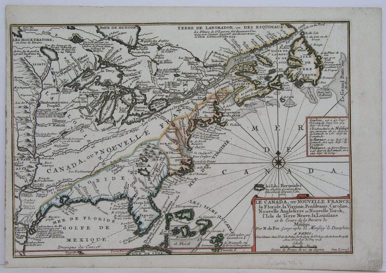
Le Canada, ou Nouvelle France, la Floride, la Virginie, Pensilanie, Caroline, Nouvelle Angleterre et Nouvelle Yorck, l'Isle de Terre Neuve, la Louisiane et le Cours de la Riviere de Misisipi
Paris: 1705. Notes: This decorative map focuses on the French possessions in North America. The treatment of French Florida is intriguing. The map shows the United States of America and parts of Southern Canada East of the Mississippi river.
"Territorial expansion of New France had reached the Mississipi River with the establishment of the first European settlement at Fort Maurepas by Pierre Le Moyne d'Iberville in 1699, sixteen years after La Salle had reached the mouth of the river. This attractive map from 'L'Atlas Curieux ou le Monde', paris, 1705, although containing geographical errors, has many interesting historical notes" -The Macdonald Stewart Foundation, Size : 232x342 (mm), 9.125x13.5 (Inches), Coloring: Hand Colored in Outline, Reference: The Macdonald Stewart Foundation, "La Decouverte du Monde Cartographes et Cosmographes", Map # 44; McCorkle 702.2, Category: ; Maps North America Great Lakes; Maps Canada; Maps Canada East; Maps United States East; Maps United States South. Excellent. Item #M4344
Notes: This decorative map focuses on the French possessions in North America. The treatment of French Florida is intriguing. The map shows the United States of America and parts of Southern Canada East of the Mississippi river.
"Territorial expansion of New France had reached the Mississipi River with the establishment of the first European settlement at Fort Maurepas by Pierre Le Moyne d'Iberville in 1699, sixteen years after La Salle had reached the mouth of the river. This attractive map from 'L'Atlas Curieux ou le Monde', paris, 1705, although containing geographical errors, has many interesting historical notes" -The Macdonald Stewart Foundation, Size : 232x342 (mm), 9.125x13.5 (Inches), Coloring: Hand Colored in Outline, Reference: The Macdonald Stewart Foundation, "La Decouverte du Monde Cartographes et Cosmographes", Map # 44; McCorkle 702.2, Category: ; Maps North America Great Lakes; Maps Canada; Maps Canada East; Maps United States East; Maps United States South.
Price: $1,250.00
