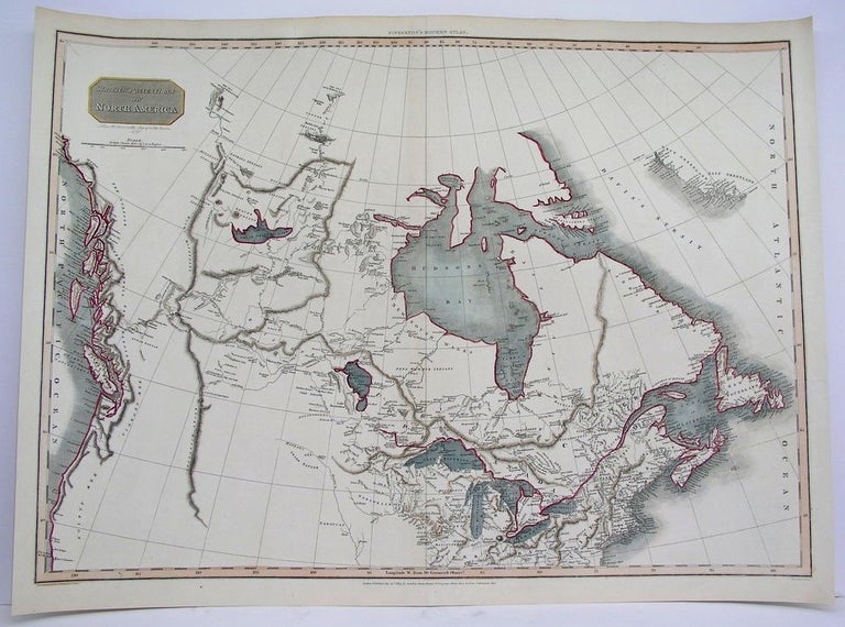
British Possessions in North America
London: Cadell & Davis... 1814. Notes: An important early 19th century map of Canada from coast to coast.
The map shows rivers, settlements, territories of First Nations peoples. Also depicts Upper and Lower Canada, Labrador, Newfoundland, New Brunswick, and Nova Scotia.
British Columbia is divided into New Norfolk, New Cromwell, New Hanover, and New Georgia (the southern portion of which would become Northern Washington State).
Western Canada is illustrated with details based on early explorers. Early forts and trading houses are depicted
, Size : 500x690 (mm), 19.625x27.125 (Inches), Coloring: Original Hand Coloring, Category: Maps Canada; Maps Canada North;. Very Good. Item #M4117
Notes: An important early 19th century map of Canada from coast to coast.
The map shows rivers, settlements, territories of First Nations peoples. Also depicts Upper and Lower Canada, Labrador, Newfoundland, New Brunswick, and Nova Scotia.
British Columbia is divided into New Norfolk, New Cromwell, New Hanover, and New Georgia (the southern portion of which would become Northern Washington State).
Western Canada is illustrated with details based on early explorers. Early forts and trading houses are depicted
, Size : 500x690 (mm), 19.625x27.125 (Inches), Coloring: Original Hand Coloring, Category: ; Maps Canada; Maps Canada Arctic.
Price: $1,250.00